
The Annapurnas are a Himalayan massif in central Nepal, whose main summit, Annapurna I (8,091 m / 26,545 ft), was in 1950 the first « 8,000er » to be climbed, by Maurice Herzog’s French expedition. For a traveler, « doing the Annapurnas » means trekking in the Annapurna Conservation Area, the country’s largest protected area: you need an ACAP permit (3,000 Nepalese rupees for a foreigner), a TIMS card and, for independent trekkers, a licensed guide. This page covers the three main treks, permits, official rules, safety and the best season.
To plan the whole trip, see our page on traveling to Nepal, our calendar of the best time to visit Nepal and our guide to altitude sickness.

Our travel deals for Annapurna
Affiliate links: we earn a commission, at no extra cost to you.
 FlightsKiwi.comCompare flights and airline combinations to Annapurna.Compare flights
- eSIMAiraloData plan to install before you leave (eSIM-compatible phone).See plans


Annapurnas: key facts
- ACAP permit: 3,000 Nepalese rupees (NPR) for a foreigner, 1,000 NPR for a SAARC national, taxes included; free for children under 10; double price if bought at a checkpoint — checked on 24 October 2026 on epermit.ntnc.org.np
- Guide and TIMS: a TIMS card is required to enter the main trekking regions, and independent trekkers must use a local licensed guide (GOV.UK, updated 1 October 2026; travel.state.gov, last updated April 9, 2026)
- Safety: do not trek alone; hazards all year round above 3,000 m (9,843 ft); insurance must include mountain rescue and helicopter costs (GOV.UK)
- Best periods: October–November and March–April; monsoon from June to September
- Highest point of the Annapurna Circuit: Thorong La pass, 5,416 m (17,769 ft)
The massif and the conservation area
The Annapurna Conservation Area covers 7,629 km² (2,946 sq mi), from 790 m (2,592 ft) up to the summit of Annapurna I, according to the Wikipedia article devoted to it. It is managed by the National Trust for Nature Conservation (NTNC), which issues the ACAP entry permit. Pokhara, on the shore of Phewa Lake, is the starting town for most treks.
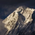
Annapurna I has a special place in the history of mountaineering: on 3 June 1950, Maurice Herzog and Louis Lachenal reached its summit by the north face, making it the first peak over 8,000 m to be climbed.
The three main Annapurna treks
| Trek | High point | Who is it for? |
|---|---|---|
| Annapurna Circuit | Thorong La pass, 5,416 m (17,769 ft) | Fit hikers ready to manage altitude; crosses valleys of Tibetan culture (Manang) as far as the Kali Gandaki |
| Annapurna Sanctuary / Base Camp | Base Camp, 4,130 m (13,550 ft) | Hikers who want to go into the heart of the massif rather than around it |
| Poon Hill (Ghorepani) | Poon Hill, 3,210 m (10,531 ft) | A first trek in Nepal, fit families: viewpoint over the Annapurnas and Dhaulagiri |
The Annapurna Circuit
The circuit starts in the Marsyangdi valley, passes through Manang, crosses Thorong La, then descends towards Muktinath and the Kali Gandaki gorge. Its length varies, according to Wikipedia, between 160 and 230 km (99 and 143 mi), because roads have been built along part of the route and everyone chooses where to walk and where to take a vehicle. Most trekkers go counterclockwise: the daily gain in altitude is more gradual and the pass crossing is safer. Trails marked in blue and red (NATT) avoid part of the roads.
The Sanctuary and Base Camp
The Sanctuary trek follows the Modi Khola valley up to the glacial cirque at the foot of Annapurna I, at 4,130 m (13,550 ft). It can be combined with Poon Hill from the same region.
Poon Hill
Poon Hill, at 3,210 m (10,531 ft) above Ghorepani, is a viewpoint famous for sunrise over the Annapurnas and Dhaulagiri. It is the shortest and lowest of the three routes; the permit and guide rules apply there as elsewhere in the conservation area.
ACAP permit, TIMS card and guide
The ACAP permit can be bought online on the NTNC portal (Visa or Mastercard payment, 2.9% fee on top, permit sent by email) or at the counter in cash, on presentation of your passport. It is « valid for single entry only », non-refundable and non-transferable; bought at a checkpoint, it costs double — checked on 24 October 2026 on epermit.ntnc.org.np.
According to the UK FCDO (GOV.UK, updated 1 October 2026), you need a valid permit and a Trekking Information Management System (TIMS) card to enter Nepal’s main trekking regions, and all foreign independent trekkers must use a local guide or porter in national parks and protected areas; if you ignore the requirements you may be fined or removed from protected areas. The U.S. State Department (travel.state.gov, last updated April 9, 2026) says foreign visitors on hiking trips, including those not with organized groups, must hold a valid TIMS card obtained through authorized trekking agencies registered with the Government of Nepal, and that solo or independent trekkers must use a local licensed guide.
| Document | Issued by | Key points |
|---|---|---|
| Nepalese visa and passport | See entry requirements for Nepal | Check the current rules for your nationality on the country page |
| ACAP permit | NTNC (online or at the counter) | 3,000 NPR for a foreigner, double at a checkpoint |
| TIMS card | Authorized trekking agencies | Required for the main trekking regions; independent trekkers also need a licensed guide |
Choosing your agency and guide
With a guide required for independent trekkers, the agency becomes the central element of the trip. GOV.UK advises using a reputable trekking agency or guide, and warns of isolated reports of guides taking inexperienced trekkers to high altitudes too quickly and then calling in expensive helicopter evacuations; it recommends being wary of trekking deals that look very cheap. Before booking, ask the agency for its registration with the Nepalese authorities, who obtains the ACAP permit and the TIMS card, the guide’s training in high-altitude first aid, and what your insurance covers (search, evacuation).
When to go to the Annapurnas
The normals for Pokhara, the gateway to the treks, show the contrast between the dry season and the monsoon. We added two calculations: the average number of rainy days on a 10-day trek, and sunrise time at Poon Hill.
| Month | Max | Min | Rain | Rainy days in 10 days | Sunshine (h/day) | Sunrise at Poon Hill on the 15th |
|---|---|---|---|---|---|---|
| January | 19.9 °C (68 °F) | 7.1 °C (45 °F) | 22 mm (0.9 in) | 0.8 | 6.6 | 07:03 |
| February | 22.7 °C (73 °F) | 9.7 °C (49 °F) | 35 mm (1.4 in) | 1.4 | 7.4 | 06:48 |
| March | 27.1 °C (81 °F) | 13.1 °C (56 °F) | 64 mm (2.5 in) | 2.1 | 7.4 | 06:20 |
| April | 30.0 °C (86 °F) | 16.1 °C (61 °F) | 142 mm (5.6 in) | 3.5 | 7.3 | 05:45 |
| May | 30.4 °C (87 °F) | 18.7 °C (66 °F) | 355 mm (14.0 in) | 5.9 | 5.4 | 05:20 |
| June | 30.8 °C (87 °F) | 21.2 °C (70 °F) | 648 mm (25.5 in) | 7.4 | 3.7 | 05:12 |
| July | 30.4 °C (87 °F) | 22.4 °C (72 °F) | 941 mm (37.0 in) | 8.3 | 3.4 | 05:22 |
| August | 30.5 °C (87 °F) | 22.3 °C (72 °F) | 839 mm (33.0 in) | 7.8 | 3.1 | 05:39 |
| September | 29.9 °C (86 °F) | 21.1 °C (70 °F) | 635 mm (25.0 in) | 6.5 | 4.4 | 05:54 |
| October | 27.9 °C (82 °F) | 17.2 °C (63 °F) | 159 mm (6.3 in) | 2.6 | 6.1 | 06:10 |
| November | 24.4 °C (76 °F) | 12.3 °C (54 °F) | 17 mm (0.7 in) | 0.4 | 7.4 | 06:31 |
| December | 21.0 °C (70 °F) | 8.3 °C (47 °F) | 12 mm (0.5 in) | 0.3 | 7.1 | 06:54 |
How to read it: on a 10-day trek, Pokhara averages less than one rainy day from November to January, against about 8 in July. October and November combine clear skies and mild temperatures at low altitude; March and April are the second season, with more showers in April. These figures are for Pokhara (827 m / 2,713 ft): at altitude it is much colder, and Wikipedia notes that Thorong La is often blocked by snow from December to March. Sunrise at Poon Hill is around 06:31 in mid-November.
GOV.UK (updated 1 October 2026) says that travel during the monsoon season (normally June to October) can be hazardous: flooding and landslides can make roads impassable, delay journeys, or cut off towns and villages for days at a time. Internal flights in high mountain areas can be delayed by poor weather and cancellations are common, so leave a margin before your international flight. In October 2014, a blizzard killed more than 43 people in the Thorong La area (Wikipedia). Official normals for other regions are on our page on the best time to visit Nepal.
Safety, health and insurance
GOV.UK (updated 1 October 2026) says to be aware of hazards all year round, especially above 3,000 m (9,843 ft): sudden weather changes and storms, avalanches, landslides, rockfalls and flooding, altitude sickness and sun exposure. It advises using a reputable trekking agency or guide, taking note of forecasts, being physically fit, and making sure your insurance includes cover for mountain rescue services and helicopter costs. The U.S. State Department (travel.state.gov, last updated April 9, 2026) says to obtain emergency medical evacuation insurance before visiting Nepal, notes that helicopter companies generally require specific evacuation insurance, pre-approval or upfront payment, and strongly discourages trekking alone. Earth tremors are common across Nepal, according to GOV.UK. For altitude, read our guide to altitude sickness.
Phone and internet on the trail
GOV.UK says that in remote areas, including long stretches of the Annapurna Circuit, mobile phone coverage is limited; it suggests renting a satellite phone and making sure friends and family know you will be out of contact. A local SIM card or eSIM helps in Kathmandu, Pokhara and villages with coverage; it does not replace satellite communication at altitude. Our travel eSIM guide explains how it works. Before heading onto the trails, see our page on an eSIM for Nepal.
Common mistakes
- Trekking alone without a licensed guide: GOV.UK and the U.S. State Department both say independent trekkers must use a local guide.
- Buying your ACAP permit at a checkpoint: it then costs double.
- Choosing the cheapest trekking deal: GOV.UK warns that very cheap deals may be scams.
- Booking your international flight the day after the trek ends, when weather can delay domestic flights.
- Setting off without insurance covering search, rescue and helicopter evacuation.
- Climbing too fast towards Thorong La: counterclockwise is chosen precisely for a more gradual gain in altitude.
See also in Nepal
Our Nepal page presents Kathmandu, Pokhara, Chitwan and the Everest region; the map of Nepal shows the trekking regions.
Frequently asked questions
How much does the Annapurna permit cost?
The ACAP permit costs 3,000 Nepalese rupees for a foreigner (taxes included), double if bought at a checkpoint, according to the NTNC. You also need the TIMS card, issued by authorized agencies.
Can you do the Annapurna Circuit without a guide?
No: GOV.UK says all foreign independent trekkers must use a local guide or porter in national parks and protected areas, and the U.S. State Department says solo or independent trekkers must use a local licensed guide. A TIMS card is also required.
What is the highest altitude on the Annapurna Circuit?
The Thorong La pass, at 5,416 m (17,769 ft).
What is the best time to go to the Annapurnas?
October–November, then March–April. According to the Pokhara normals, it rains less than one day in ten from November to January, against more than eight in ten in July.
Is the Annapurna Circuit dangerous?
The main risks are altitude, weather (snow on the pass in winter, landslides during the monsoon) and remoteness. GOV.UK and the U.S. State Department recommend insurance covering mountain rescue and helicopter evacuation, and a reputable agency with an experienced guide.
Who first climbed Annapurna?
Maurice Herzog and Louis Lachenal, of the 1950 French expedition: it was the first peak over 8,000 m to be climbed.
Our sources
- National Trust for Nature Conservation, ACAP e-permit portal (epermit.ntnc.org.np), consulted on 24 October 2026
- UK FCDO, Nepal travel advice (GOV.UK, updated 1 October 2026): trekking, monsoon, earthquakes, health
- U.S. Department of State, Nepal country information (travel.state.gov, last updated April 9, 2026): trekking in Nepal, TIMS card, evacuation insurance
- Wikipedia articles « Annapurna », « Annapurna Conservation Area », « Annapurna Circuit », « Annapurna Sanctuary » and « Poon Hill »
- 1991–2020 normals for Pokhara airport (827 m / 2,713 ft), World Meteorological Organization and Nepal’s Department of Hydrology and Meteorology (DHM), as reproduced in the Wikipedia article « Pokhara »
- Astronomical calculations: NOAA solar algorithm, applied by Destination de Voyage to the coordinates of Poon Hill (15th of each month, year 2027, clear horizon)
- Our methodology
Updated November 2026. Prices, hours and access rules may change: check the official website before you go.