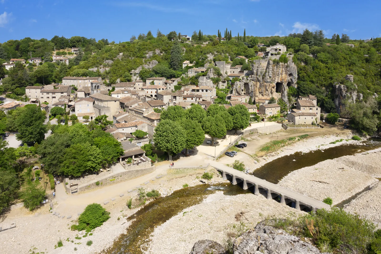
The Gorges du Tarn are a canyon 400 to 600 m (1,312 to 1,969 ft) deep, carved by the Tarn River over 53 km (33 mi) between Quézac and Le Rozier, in the Lozère département (and, for a small part, in Aveyron), between the Causse Méjean and the Causse de Sauveterre plateaus. Access is free and unrestricted: you can explore them by car along the road at the bottom of the gorges, by canoe, by boat with the boatmen of La Malène, on foot, or from the viewpoints on the plateaus. Together with the Gorges de la Jonte, they have been a Grand Site de France since 21 May 2024. Here are the villages, the canoe routes published by the tourist office, the rules (camping, dogs, swimming), shuttle access and month-by-month weather.
The gorges combine well with the Millau Viaduct, downstream on the Tarn, and more broadly with our guide to travel in France.

Our travel deals for Gorges du Tarn
Affiliate links: we earn a commission, at no extra cost to you.
 FlightsKiwi.comCompare flights and airline combinations to Gorges du Tarn.Compare flights

Gorges du Tarn: key facts
- Where: Lozère and Aveyron; main villages: Ispagnac, Quézac, Castelbouc, Sainte-Enimie, Saint-Chély-du-Tarn, La Malène, Les Vignes, Le Rozier.
- Access: natural site open at all times, no ticket. Only the activities (canoeing, boat trips, caves) are paid, from private operators.
- Canoeing: routes from 7-8 km (4-5 mi, 2 hours) to 2-3 days according to the tourist office; booking preferable; helmet compulsory after the Pas de Soucy — checked on 23 October 2026 on cevennes-gorges-du-tarn.com
- Wild camping: prohibited in the protected site of the Gorges du Tarn and the Jonte, according to the tourist office.
- Without a car: summer liO shuttles at €2 per trip (line 258 Florac – Le Rozier) in July and August.
- Cash: few ATMs (Sainte-Enimie, Ispagnac, Meyrueis, Florac): bring cash, advises the tourist office.
The Gorges du Tarn at a glance
The Grands Causses, limestone plateaus, are cut by three gorges: those of the Tarn, the Jonte and the Dourbie. According to Wikipedia, the Tarn crosses this limestone plateau in a canyon 400 to 600 m (1,312 to 1,969 ft) deep, which it carved between Quézac and Le Rozier. Dozens of springs feed the river, including the Source de Burle at Sainte-Enimie. According to the tourist office, the Grand Site covers more than 20,000 hectares (about 49,000 acres) and 14 municipalities, with around 4,500 inhabitants. The Causses and Cévennes are also a UNESCO World Heritage Site.
What to see in the Gorges du Tarn
The villages
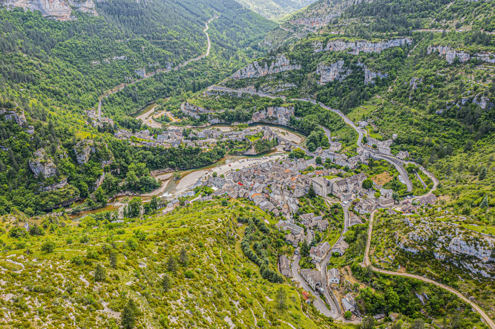
- Sainte-Enimie: listed among Les Plus Beaux Villages de France (the Most Beautiful Villages of France); cobbled lanes, covered grain market, Notre-Dame-du-Gourg church, chapter house of the former monastery (open in July and August), and the Source de Burle with a boardwalk route. The hermitage path takes 45 minutes round trip, short but steep.
- La Malène: the boatmen’s village, starting point for boat trips to the Détroits (the Narrows) and the Cirque des Baumes.
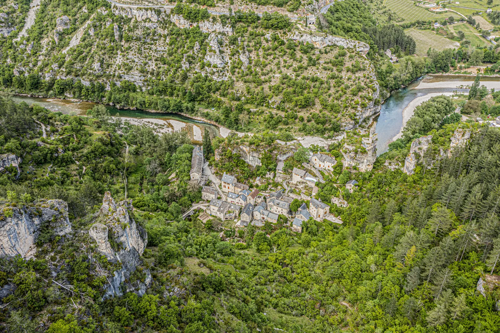
- Castelbouc: a semi-troglodyte hamlet clinging to the cliff.
- Saint-Chély-du-Tarn: at the foot of its cirque, with the Cénaret cave and its small underground lake.
- Ispagnac and Quézac: the upstream entrance to the gorges, nicknamed « the gardens of Lozère » by the tourist office.
The viewpoints
To see the canyon from above, the tourist office lists four panoramas on the plateau edges: the Roc des Hourtous (view over the Détroits), the Point Sublime (over the Cirque des Baumes), the Domaine des Boissets (over Sainte-Enimie) and the Saltadou (over the Saint-Chély-du-Tarn cirque). The Détroits, the narrowest section, can also be seen from the river.
Canoeing down the Tarn: which route to choose
Rental companies provide canoe, kayak or paddleboard, paddles and life jackets, and bring you back to the start by bus. These are the routes published by the tourist office; we added the average speed they imply (Destination de Voyage calculation: distance ÷ stated duration), useful for judging the effort.
| Option | Route | Distance | Stated duration | Average speed (calculated) | Note |
|---|---|---|---|---|---|
| Family or beginner | Castelbouc → Sainte-Enimie or La Malène → Cirque des Baumes | 7 to 8 km (4 to 5 mi) | 2 h | 3.8 km/h (2.4 mph) | Very easy |
| Energetic | Les Vignes → Le Rozier | 11 km (7 mi) | 2 to 3 h | 4.4 km/h (2.7 mph) | More athletic; rafting in spring if the water level allows; helmet compulsory |
| Heritage | Castelbouc → La Malène | 20 km (12 mi) | 5 h | 4.0 km/h (2.5 mph) | Villages along the river |
| Spectacular | Sainte-Enimie → Pas de Soucy | 23 km (14 mi) | 6 h | 3.8 km/h (2.4 mph) | Through the Détroits, endurance needed |
| Adventurer | Quézac → Cirque des Baumes / Montbrun → Le Rozier | 40 km (25 mi) / 47 km (29 mi) | 2 days / 3 days | — | Multi-day trip with nights in accommodation (wild camping is prohibited in the protected site) |
According to the tourist office’s FAQ, the Tarn is a family-friendly river as far as the Point Sublime; after the Pas de Soucy and as far as Le Rozier, paddling is more athletic and a helmet is compulsory. Booking is still preferable to guarantee equipment. Every June, the Tarn Water Race brings together more than 200 paddlers on a course of up to 71 km (44 mi).
The boatmen of La Malène
If you would rather not paddle, the boatmen of La Malène take visitors by boat through the Détroits and the Cirque des Baumes, telling the story of the gorges and the river, according to the tourist office. Schedules and prices are set by the boatmen themselves: ask at the La Malène information office.
Hiking in the gorges
The GR 736 « Gorges et vallée du Tarn » follows the river; the tourist office presents it as a 2-3 day hike on its gorges section. The Cévennes National Park has also designed day hikes that can be reached by summer shuttle. Another idea published by the tourist office: a « zero-carbon » outing from Castelbouc to Sainte-Enimie by canoe, returning on foot along the left-bank path.
Rules to know (and common mistakes)
- Camping wild in the gorges: prohibited in the protected site of the Gorges du Tarn and the Jonte. Wild camping is only tolerated in the Cévennes National Park, under conditions.
- Letting your dog run free: from 15 April to 30 June, the law prohibits walking a dog off the leash outside forest tracks; in the core zone of the National Park, a leash is compulsory all year.
- Swimming anywhere: the tourist office recommends the swimming spots in village centers, where the water is monitored; water quality can be checked on the Regional Health Agency (ARS) map, and cyanobacteria monitoring is published for the upper Tarn.
- Setting off without cash: some cafés and small shops do not accept cards, and ATMs are rare.
- Driving on the fuel reserve: gas stations are few (Florac, Ispagnac, Sainte-Enimie, Le Rozier, Meyrueis).
Best time to visit the Gorges du Tarn
Météo-France publishes no climate sheet for the bottom of the gorges. The nearest reference station is Millau, at 712 m (2,336 ft) above sea level, downstream of the gorges: its normals give a trend, as the canyon floor (400 to 600 m, or 1,312 to 1,969 ft, below the plateau) is generally milder. We add the day length at Sainte-Enimie, useful for timing a canoe trip.
| Month (15th) | Max at Millau | Rainy days (≥ 1 mm) | Sunshine (h) | Sunrise | Sunset | Day length |
|---|---|---|---|---|---|---|
| January | 6.3 °C (43 °F) | 8.6 | 98 | 08:19 | 17:32 | 9 h 13 |
| February | 7.7 °C (46 °F) | 7.3 | 129 | 07:46 | 18:14 | 10 h 28 |
| March | 11.5 °C (53 °F) | 7.8 | 173 | 06:59 | 18:51 | 11 h 53 |
| April | 14.3 °C (58 °F) | 9.4 | 187 | 07:03 | 20:30 | 13 h 27 |
| May | 18.2 °C (65 °F) | 8.5 | 224 | 06:19 | 21:06 | 14 h 47 |
| June | 22.7 °C (73 °F) | 6.5 | 267 | 06:01 | 21:32 | 15 h 31 |
| July | 25.7 °C (78 °F) | 5.5 | 301 | 06:15 | 21:28 | 15 h 12 |
| August | 25.8 °C (78 °F) | 5.9 | 270 | 06:49 | 20:52 | 14 h 03 |
| September | 20.9 °C (70 °F) | 6.8 | 212 | 07:24 | 19:57 | 12 h 33 |
| October | 15.8 °C (60 °F) | 8.3 | 140 | 08:00 | 19:02 | 11 h 02 |
| November | 10.1 °C (50 °F) | 9.9 | 98 | 07:41 | 17:19 | 9 h 38 |
| December | 7.2 °C (45 °F) | 8.7 | 98 | 08:15 | 17:07 | 8 h 52 |
How to read it: July is the sunniest month (about 300 hours) and the driest (5.5 rainy days); it is also the season of the shuttles, village events and the heaviest crowds. May, June and September offer long days with highs of 18 to 23 °C (64 to 73 °F) at Millau. From October to March, days shorten to under 11 h 30, and the tourist office advises checking the opening periods of accommodation, restaurants and sites, some of which close out of season. For canoeing in spring, the Les Vignes – Le Rozier route can be done as rafting if the water level is high enough.
Getting there
- By car: via the toll-free A75 (exits 38 Marvejols, 39 Le Monastier, 39.1 Chanac or 40 La Canourgue) or via the RN 106 between Alès and Mende.
- By train: stations at Banassac – La Canourgue (25 km or 16 mi from Sainte-Enimie), Mende (25 km or 16 mi from Florac), Millau (42 km or 26 mi from Meyrueis) or Alès (70 km or 43 mi from Florac), according to the tourist office.
- By liO bus: line 251 Mende – Florac – Alès, line 215 Millau – Meyrueis, all year.
- Summer shuttles: in July and August, 9 lines in Lozère at €2 per trip (€1.50 with a 10-trip booklet), payable to the driver in cash or through the liO app; line 258 serves the gorges from Florac to Le Rozier. The announced 2026 dates ran from 5 July to 29 August.
- Once there: a rural area; apart from hiking, the tourist office advises a rental car to be independent.
What to see nearby
To the south, the Millau Viaduct spans the Tarn valley. To the east, the gorges of the Ardèche also lend themselves to canoeing; to the southeast, Montpellier is the nearest large city. Around the gorges: the Gorges de la Jonte, the Causse Méjean, Mont Aigoual (1,565 m or 5,135 ft) and the Aven Armand cave.
Frequently asked questions
Where are the Gorges du Tarn?
In Occitanie, mainly in Lozère and partly in Aveyron, between the Causse Méjean and the Causse de Sauveterre, from Quézac to Le Rozier.
Do you have to pay to visit the Gorges du Tarn?
No, the natural site is free to enter. Only the activities (canoeing, boatmen’s boat trips, caves, guided tours) are paid.
Which canoe route should you choose in the Gorges du Tarn?
For families, Castelbouc – Sainte-Enimie or La Malène – Cirque des Baumes (7 to 8 km or 4 to 5 mi, 2 hours). Sporty paddlers will choose Les Vignes – Le Rozier (11 km or 7 mi), where a helmet is compulsory.
Can you camp wild in the Gorges du Tarn?
No: wild camping is prohibited in the protected site of the Gorges du Tarn and the Jonte, according to the tourist office. It is tolerated under conditions in the Cévennes National Park.
What is the prettiest village in the Gorges du Tarn?
Sainte-Enimie is listed among Les Plus Beaux Villages de France; La Malène, Castelbouc and Saint-Chély-du-Tarn are also stops recommended by the tourist office.
Can you visit the Gorges du Tarn without a car?
In July and August, yes, with the €2 liO shuttles (line 258 Florac – Le Rozier); the rest of the year, service is limited to a few regular lines.
Our sources
- Gorges du Tarn, Causses and Cévennes tourist office (cevennes-gorges-du-tarn.com): pages « Les Gorges du Tarn, un canyon à parcourir », « Canoë, kayak… », « Grand Site de France », « Sainte-Enimie », « Accès/Transports » and FAQ, consulted on 23 October 2026
- Wikipedia: « Gorges du Tarn » article (geography, geology), consulted on 23 October 2026
- Aubrac – Gorges du Tarn tourism (aubrac-gorgesdutarn.com): page « Gorges du Tarn », consulted on 23 October 2026
- Météo-France: 1991-2020 climate sheet, Millau station (12145001)
- Sunrise and sunset: Destination de Voyage calculation, NOAA solar algorithm, Europe/Paris time zone, approximate coordinates of Sainte-Enimie, on the 15th of each month (year 2027)
- Our methodology
Updated November 2026. Prices and hours may change: check the official website before you go.