
Uluru (Ayers Rock), at the heart of Uluṟu-Kata Tjuṯa National Park, is visited with a park pass bought in advance, by walking around the monolith rather than climbing it: the climb has been permanently closed since 26 October 2019. The park is open every day, but its hours change every month, and visitors must have left by closing time. This page brings together the park’s official rules, the walks with their durations, and a calculation that guidebooks do not give: the time between the park opening and sunrise, month by month.
Uluru is in the Red Centre, more than 450 km (280 mi) from Alice Springs by road. For the overall organization of your trip, see our guide to visiting Australia.

Our travel deals for Uluru
Affiliate links: we earn a commission, at no extra cost to you.
 FlightsKiwi.comCompare flights and airline combinations to Uluru.Compare flights
- Tickets and toursTiqetsEntry tickets and guided tours to book online; compare with the official price.See tickets
- eSIMAiraloData plan to install before you leave (eSIM-compatible phone).See plans



Uluru: key facts
- Park pass: AU$38 per adult (18 and over) for 3 days, AU$50 for an annual pass; free for under-18s — checked on 15 October 2026 on uluru.gov.au
- Purchase: online through the park’s official ticketing, or at the entry station if buying online is not possible; printed pass or on your phone, to be scanned at the gate — checked on 15 October 2026 on uluru.gov.au
- Park hours: open every day of the year, from 5 am–9 pm (December–February) to 6:30 am–7:30 pm (June–July); you must leave before closing — checked on 15 October 2026 on uluru.gov.au
- Cultural Centre: 7 am–5:45 pm every day — checked on 15 October 2026 on uluru.gov.au
- Climb: permanently closed since 26 October 2019 — checked on 15 October 2026 on uluru.gov.au
- Duration: allow several days for Uluru and Kata Tjuta; the base walk around the rock alone takes 3.5 hours according to the park.
- Prices recorded on 15 October 2026, subject to change: check before you go.
Park pass: official vs resellers
The only mandatory entry fee is the national park pass, sold by Parks Australia on the official passes page. It is valid only for Uluṟu-Kata Tjuṯa: Kakadu requires a separate pass, and the other parks in the Northern Territory come under the territory government. Tour operators and authorized resellers get a 5% discount on the total when they buy online; if your excursion includes the pass, check it on the invoice.
Excursions (sunrise, camel rides, dinners under the stars, the Field of Light installation) are sold by private operators in Yulara and do not replace the pass. We do not show a price difference between channels, as we did not record both on the same day.
Park hours month by month
| Month | Park opening hours | Sunrise (15th) | Sunset (15th) | Opening → sunrise | Sunset → closing |
|---|---|---|---|---|---|
| January | 5:00 am – 9:00 pm | 06:08 | 19:41 | 68 min | 79 min |
| February | 5:00 am – 9:00 pm | 06:31 | 19:28 | 91 min | 92 min |
| March | 5:30 am – 8:30 pm | 06:47 | 19:02 | 77 min | 88 min |
| April | 5:30 am – 8:00 pm | 07:00 | 18:30 | 90 min | 90 min |
| May | 6:00 am – 7:30 pm | 07:15 | 18:08 | 75 min | 82 min |
| June | 6:30 am – 7:30 pm | 07:29 | 18:03 | 59 min | 87 min |
| July | 6:30 am – 7:30 pm | 07:30 | 18:12 | 60 min | 78 min |
| August | 6:00 am – 7:30 pm | 07:13 | 18:27 | 73 min | 63 min |
| September | 5:30 am – 7:30 pm | 06:43 | 18:39 | 73 min | 51 min |
| October | 5:00 am – 8:00 pm | 06:11 | 18:51 | 71 min | 69 min |
| November | 5:00 am – 8:30 pm | 05:49 | 19:10 | 49 min | 80 min |
| December | 5:00 am – 9:00 pm | 05:49 | 19:31 | 49 min | 89 min |
How to read it: in June–July, opening (6:30 am) comes about an hour before sunrise, which leaves time to reach the viewing area; in December, the gap is under 50 minutes, with opening at 5 am. In the evening, closing always falls after sunset, but you then have to drive back to Yulara before the deadline: do not linger.
Best time to visit Uluru
According to the park, the best time runs from May to September, with maximums of about 20 to 30 °C (68 to 86 °F); August and September are the best months for wildflowers. From October to March, days regularly exceed 35 °C (95 °F): the park then advises not walking after 11 am. In return, summer thunderstorms can fill the waterholes and send waterfalls down the rock.
| Month | Max temp | Min temp | Rain | Walking time between sunrise and 11 am | Verdict |
|---|---|---|---|---|---|
| January | 38.4 °C (101 °F) | 23.0 °C (73 °F) | 29.7 mm (1.2 in) | 4 h 52 | ❌ |
| February | 37.0 °C (99 °F) | 22.3 °C (72 °F) | 40.8 mm (1.6 in) | 4 h 29 | ❌ |
| March | 34.5 °C (94 °F) | 19.5 °C (67 °F) | 28.6 mm (1.1 in) | 4 h 13 | ❌ |
| April | 30.1 °C (86 °F) | 14.7 °C (58 °F) | 15.6 mm (0.6 in) | 4 h 00 | ⚠️ |
| May | 24.3 °C (76 °F) | 9.2 °C (49 °F) | 11.1 mm (0.4 in) | 3 h 45 | ✅ |
| June | 20.3 °C (69 °F) | 5.5 °C (42 °F) | 17.4 mm (0.7 in) | 3 h 31 | ✅ |
| July | 20.8 °C (69 °F) | 4.5 °C (40 °F) | 16.8 mm (0.7 in) | 3 h 30 | ✅ |
| August | 23.8 °C (75 °F) | 6.0 °C (43 °F) | 5.3 mm (0.2 in) | 3 h 47 | ✅ |
| September | 29.1 °C (84 °F) | 10.8 °C (51 °F) | 8.0 mm (0.3 in) | 4 h 17 | ✅ |
| October | 32.5 °C (90 °F) | 15.2 °C (59 °F) | 22.8 mm (0.9 in) | 4 h 49 | ⚠️ |
| November | 35.0 °C (95 °F) | 18.5 °C (65 °F) | 34.2 mm (1.3 in) | 5 h 11 | ❌ |
| December | 36.4 °C (98 °F) | 21.0 °C (70 °F) | 46.5 mm (1.8 in) | 5 h 11 | ❌ |
Winter nights are cold (average minimum of 4.5 °C / 40 °F in July): bring a jacket for sunrise. To combine the Red Centre with the coast, see the best time to visit Australia.
What to see: walks and durations
| Walk | Distance | Duration given by the park | Level |
|---|---|---|---|
| Uluru base walk | 10.6 km (6.6 mi), loop | 3 h 30 | Grade 3 |
| Mala walk (foot of the rock, caves and rock art) | 2 km (1.2 mi) round trip | 1 h 30 | Grade 2 |
| Kuniya walk and Muṯitjulu waterhole | 1 km (0.6 mi) round trip | 30 to 45 min | Grade 2 |
| Kata Tjuta: Waḻpa Gorge | 2.6 km (1.6 mi) round trip | 1 h | Grade 3 |
| Kata Tjuta: Valley of the Winds (full circuit) | 7.4 km (4.6 mi), loop | 3 to 4 h | Grade 4 |
- 1 day: sunrise, Mala walk and Kuniya walk, Cultural Centre in the hot hours, sunset.
- 2 days: add the full base walk early in the morning and Waḻpa Gorge at Kata Tjuta.
- 3 days: add the Valley of the Winds; the 3-day pass covers everything.
The Cultural Centre, near the rock, presents Tjukurpa (the law and culture of the Aṉangu, the traditional owners): it is the right stop before the walks, and a refuge during the hot hours.
Getting there: air, road and distances
- By air: Yulara has its own airport, Ayers Rock/Connellan (code AYQ) — checked on 15 October 2026 on uluru.gov.au
- By road: Uluru is 465 km (289 mi) from Alice Springs, about 5.5 hours’ direct drive according to the park; the Red Centre Way also links Watarrka (Kings Canyon) and the MacDonnell Ranges over several days.
- On site: accommodation is concentrated in Yulara, 13 km (8 mi) as the crow flies from the center of Uluru and 26 km (16 mi) from Kata Tjuta (Destination de Voyage calculation, great-circle distances; the road is longer).
The UK FCDO (GOV.UK, updated 19 March 2026) advises preparing thoroughly if you drive in remote outback areas: take a roadworthy vehicle fitted with GPS and 2 spare tyres, good maps and extra food, water and fuel, and plan your route carefully. It adds that mobile coverage outside cities and large towns can be very limited or non-existent, and that Northern Territory Police have warned tourists to stay off unsurfaced tracks in remote areas of Central Australia. Fuel stops are far apart in the interior: do not judge distances by what you are used to.
Accessibility
According to the park, most walks have wheelchair-accessible sections, with levels ranging from easy to moderate. Parks Australia publishes a detailed accessibility guide for the park (link from the « Plan » section). The Valley of the Winds (grade 4), with its unstable rocks, is not suitable.
Common mistakes (official rules)
- Thinking you can climb Uluru: the climb has been closed since 2019, in line with Aṉangu law.
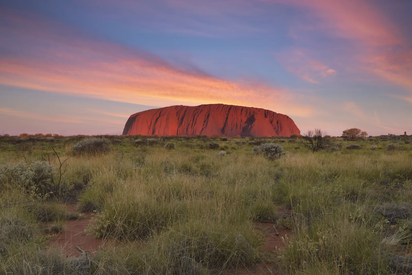
- Photographing sensitive sites: this is prohibited; they are marked on maps and by signs. The park advises photographing the northeast face 1 to 2 hours before sunset, when shadow covers these sites.
- Bringing a drone: drones and remote-controlled devices are prohibited in the park, with penalties.
- Staying after closing: all visitors must have left the park.
- Setting off walking in late morning in summer: the park advises finishing before 11 am; the Valley of the Winds is closed beyond the first lookout (Karu) from 11 am when the forecast or actual temperature reaches 36 °C (97 °F).
- Forgetting water: carry plenty, and take extra water, food and fuel if you drive in remote areas.
Uluru in figures: name, history and joint management
- Height: 348 m (1,142 ft) above the plain; circumference at the base: 9.4 km (5.8 mi) (the base walk is 10.6 km / 6.6 mi because it moves away from the rock).
- Kata Tjuṯa: its highest dome rises 546 m (1,791 ft) above the plain, higher than Uluru.
- The name: Uluṟu is a Pitjantjatjara word with no English translation. The explorer William Gosse, the first non-Aboriginal person to see the rock, in 1873, named it Ayers Rock after Sir Henry Ayers, then Chief Secretary of South Australia. The official dual name dates from 1993; the order was reversed in 2002: « Uluṟu / Ayers Rock ».
- 1985: after more than 35 years of claims, the land is handed back to the Aṉangu, recognized as traditional owners.
- Management: the park is jointly managed by the Aṉangu and the Australian government. Its 12-member board includes 8 Aboriginal members nominated by the traditional owners.
- World Heritage: the park is on the UNESCO list on two counts, for its natural and cultural values.
For the Aṉangu, Uluru and Kata Tjuṯa were shaped by creator ancestors: this is Tjukurpa, at once traditional law, stories and spirituality. It is what explains the ban on climbing and the zones where photography is prohibited.
What to see nearby
Kata Tjuta, in the same park, combines with Uluru on the same pass. Kings Canyon (Watarrka) and Alice Springs complete a Red Centre circuit, presented in our Australia travel guide. Many travelers continue to Sydney on a domestic flight: see our guide to visiting Sydney and our page on the Sydney Opera House.
Frequently asked questions
How much does it cost to enter Uluru?
The national park pass costs AU$38 per adult for 3 days and AU$50 for a year; it is free for under-18s (prices recorded on 15 October 2026 on uluru.gov.au).
Can you still climb Uluru?
No. The climb has been permanently closed since 26 October 2019, out of respect for Aṉangu law and culture.
What is the best time to go to Uluru?
May to September according to the park, with 20 to 30 °C (68 to 86 °F) in the afternoon. June–July nights are cold (average minimum of about 4.5 °C / 40 °F).
How long does it take to walk around Uluru?
The full base walk is 10.6 km (6.6 mi) and the park gives 3 hours 30 minutes of walking. In the hot season, start at sunrise and finish before 11 am.
How do you get to Uluru?
By air to Ayers Rock airport (AYQ), at Yulara, or by road from Alice Springs (465 km / 289 mi, about 5.5 hours).
Why is Uluru also called Ayers Rock?
The explorer William Gosse named it Ayers Rock in 1873, after Sir Henry Ayers, Chief Secretary of South Australia. Uluṟu is the much older Pitjantjatjara name. The official name has been « Uluṟu / Ayers Rock » since 2002; the park uses Uluṟu.
Our sources
- Parks Australia, uluru.gov.au: pass, opening hours, access, recommended season, walks, photography, climb closure, consulted on 15 October 2026
- Climate normals: Bureau of Meteorology (BoM), Yulara Aero station (Ayers Rock airport), 1991–2020, via the Wikipedia article « Yulara » which cites BoM statistics; January maximum confirmed by uluru.gov.au
- UK Foreign, Commonwealth & Development Office (GOV.UK), Australia travel advice: Safety and security section (driving in the outback, mobile phones), updated 19 March 2026, read on 26 October 2026
- Astronomical calculations: NOAA solar algorithm (Global Monitoring Laboratory), IANA time zone Australia/Darwin, applied by Destination de Voyage to Uluru’s coordinates (15th of each month, year 2027)
- Distances: Destination de Voyage calculation (great-circle distance between approximate coordinates)
- Parks Australia, uluru.gov.au: « Amazing facts », « Ayers Rock or Uluru? », « Joint management » and « Culture » pages (figures, name, 1985 handback, joint management, Tjukurpa), consulted on 16 October 2026
- Our methodology
Updated November 2026.