
Milford Sound (Piopiotahi in Māori) can be visited without an entry ticket: the fjord is part of Fiordland National Park, and you pay only for the cruise, the scenic flight or parking near the terminal. It is reached by the Milford Road (SH94), 120 km (75 mi) from Te Anau, with no fuel station on the way, through the Homer Tunnel, which is controlled by traffic lights in summer. This page gathers the official guidance from the Department of Conservation (DOC): the road, parking, recommended stops, winter, natural hazards, and sunrise and sunset times month by month.
Milford Sound is the highlight of the South Island. For the overall itinerary, see our New Zealand travel guide and our page on the best time to visit New Zealand.

Our travel deals for Milford Sound
Affiliate links: we earn a commission, at no extra cost to you.
 FlightsKiwi.comCompare flights and airline combinations to Milford Sound.Compare flights
- eSIMAiraloData plan to install before you leave (eSIM-compatible phone).See plans


Milford Sound: key facts
- Access: Milford Road (SH94) from Te Anau, 120 km (75 mi), 240 km (149 mi) round trip — checked on 27 October 2026 on doc.govt.nz
- Entry: no entry fee to the national park; cruises and flights are booked with commercial operators.
- Fuel: no fuel station or shop between Te Anau and Milford Sound: fill up before you set off.
- Parking: paid near the boat terminal; free parking a 20-minute walk away along the fjord shore (DOC brochure).
- Homer Tunnel: 1.2 km (0.7 mi) long at 945 m (3,100 ft) elevation; traffic lights in summer, waits of up to 20 minutes possible.
- Winter (May to September): snow and ice, chains sometimes required (rental in Te Anau), avalanche risk.
- Drones: prohibited without a DOC permit.
Milford Sound at a glance
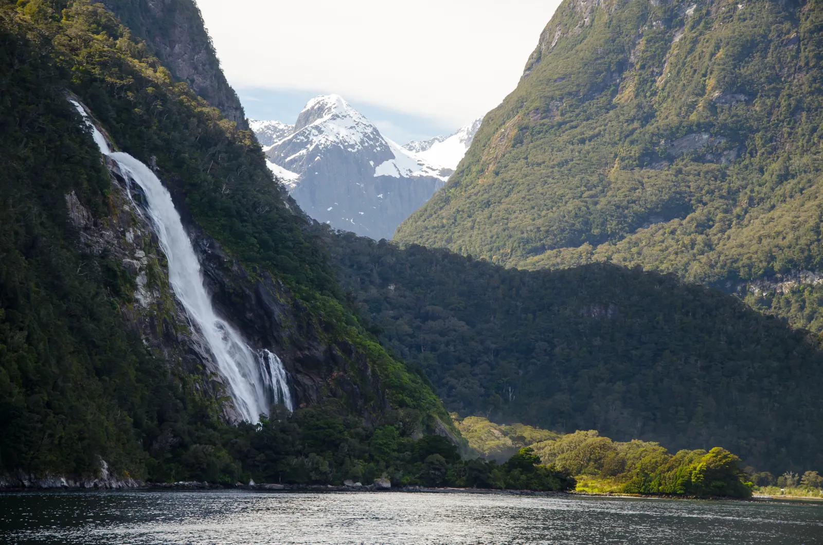
According to the DOC, Milford Sound/Piopiotahi lies in the north-west of Fiordland National Park, created in 1952, which covers more than 1.2 million hectares (about 3 million acres) and was declared a World Heritage Area in 1986. Fourteen fjords cut into the park, from Milford Sound in the north to Preservation Inlet in the south; some extend up to 40 km (25 mi) inland.
The landscape was carved by glaciers. Mitre Peak, one of the most photographed peaks in the world according to the DOC, rises 1,692 meters (5,551 ft) straight out of the water. Beneath the surface, the mountains plunge to a depth of 265 meters (869 ft). It is also one of the wettest places in the country: up to 7 meters (23 ft) of rain a year according to the DOC.
The Māori name, Piopiotahi, refers to the piopio, an endemic thrush that is probably extinct today. The English name comes from the Welsh captain John Grono, who named it after his home town of Milford Haven. Māori came to the area for a translucent green stone (takiwai) near the mouth of the fjord.
What you pay for (and what is free)
There is no entry ticket for Milford Sound. The DOC says that cruises and scenic flights are booked with operators, on site or in advance. The only cost linked to the site itself mentioned by the DOC is parking: it is paid at the car parks near the boat terminal, while a free car park lies a 20-minute walk along the shore. The DOC does not publish the parking charge: ask on site.
Cruise, flight or kayak: choosing well
A cruise on the fjord remains the most common way to see Milford Sound. According to the DOC brochure, the terminal from which all cruises leave is a 10-minute walk from the car park, along a covered walkway. Before booking, compare: the actual time on the water, the departure point (from Milford, or a coach package from Te Anau or Queenstown), the cancellation terms for weather or road closure, and what is included (transport, meals). The Piopiotahi Marine Reserve, one of the 10 marine reserves of Fiordland according to the DOC, covers the fjord itself.
The Milford Road: preparing the drive
The road is part of SH94. The DOC presents it as one of the most spectacular roads in the country, but also as a remote road, narrow and winding in places. Its official guidance:
- Distances: Te Anau to Milford and back, 240 km (149 mi); Queenstown to Milford and back, 600 km (373 mi). The DOC recommends starting from Te Anau.
- Time: the DOC gives « about 2 hours » without stopping on its web page and « at least 2 h 15 min » in its brochure; it advises allowing an eight-hour day from Te Anau to include stops, short walks and a cruise. From Queenstown, it states 12 to 14 hours round trip.
- Supplies: no shop or fuel station between Te Anau and Milford; bring water and food, and an insect repellent (there are sandflies).
- Toilets: only at Te Anau, Knobs Flat and Milford.
- Mobile network: limited; fiber has been installed along the road and the DOC lists a few points now covered (Te Anau Downs, Totara campground, The Divide, Milford Sound).
- Camping: freedom camping is prohibited within 200 m (656 ft) of the road; DOC campgrounds must be booked online; there is no dump station for motorhomes on the road.
- Wildlife: kea, threatened parrots, live along the road: do not feed them.
The DOC says that the road is particularly busy during the summer season, from October to April, and that closures or delays should be expected because of weather, rockfall and, in winter, snow and avalanches. Check the state of SH94 before you set off, on the NZTA road agency website.
The UK FCDO (GOV.UK, updated 19 March 2026) notes that New Zealand highways can be narrow, winding and hilly, and the U.S. State Department (travel.state.gov, last updated May 7, 2026) says there is very limited cell phone coverage on large portions of scenic highway in the South Island, which is remote and has little traffic. All traffic in New Zealand drives on the left.
The Homer Tunnel
Cut at 945 m (3,100 ft) elevation, the Homer Tunnel is 1.2 km (0.7 mi) long, with a steep slope towards Milford, and about 3.81 m (12.5 ft) high. In summer, at peak times, lights control the alternating traffic and can cause waits of up to 20 minutes. Work began in 1935; the DOC gives 1953 as the completion year in its brochure and driving tips page, but 1954 on its area overview page.
In winter
From May to September, the road can be covered in snow and ice. The DOC advises starting after 9 am, driving with extreme care in shaded areas and checking whether chains are required; you can rent them in Te Anau, as long as you know how to fit them. Between the Hollyford Road junction and The Chasm, the road is a no-stopping zone because of avalanche risk, and the Marian Corner gates close in case of danger. If you are not comfortable, the DOC recommends taking the bus.
Stops recommended by the DOC
The DOC’s « Te Anau Milford Highway » brochure numbers the stops from Te Anau. A selection, with the official distances and walking times:
| Stop | Distance from Te Anau | Walk (DOC duration) |
|---|---|---|
| Mirror Lakes | 56 km (35 mi) | 10 min; reflections of the Earl Mountains |
| Knobs Flat | 62 km (39 mi) | Avalanche information panels; last flush toilets before Milford |
| Lake Gunn | 79 km (49 mi) | Easy loop in red beech forest (from Cascade Creek, km 76 / mile 47) |
| The Divide | 83 km (52 mi) | Key Summit: 3 h round trip via the Routeburn Track |
| Lake Marian | Hollyford Road (after Marian Corner, km 87 / mile 54) | 3 h 30 min round trip |
| Homer Tunnel | 99 km (62 mi) | — |
| The Chasm | 110 km (68 mi) | 20 min round trip; a series of powerful falls |
| Milford Sound | 120 km (75 mi) | Foreshore Walk (30 min); Lookout Track (10 min) |
At Milford itself, the Foreshore Walk starts from the entrance to the main car park and follows the shoreline; it is, according to the DOC, one of the best viewpoints of Mitre Peak.
Best time to visit
Rain is part of the experience: up to 7 m (23 ft) a year according to the DOC, which feeds the waterfalls. The DOC points out that Fiordland weather is highly changeable, that cold, snow, strong wind and heavy rain can occur at any time of year, and refers to NIWA forecasts for Milford Sound. For the climate season by season, see our page on the best time to visit New Zealand. As for light, here are sunrise and sunset at Milford Sound on the 15th of each month.
| Month | Sunrise | Sunset | Day length |
|---|---|---|---|
| January | 06:21 | 21:32 | 15 h 11 min |
| February | 07:05 | 20:58 | 13 h 54 min |
| March | 07:43 | 20:10 | 12 h 27 min |
| April | 07:21 | 18:14 | 10 h 52 min |
| May | 07:57 | 17:31 | 9 h 33 min |
| June | 08:23 | 17:13 | 8 h 50 min |
| July | 08:20 | 17:27 | 9 h 07 min |
| August | 07:46 | 18:00 | 10 h 14 min |
| September | 06:52 | 18:36 | 11 h 44 min |
| October | 06:56 | 20:12 | 13 h 16 min |
| November | 06:11 | 20:55 | 14 h 44 min |
| December | 05:56 | 21:29 | 15 h 33 min |
What the figures show: in December, daylight lasts 15 h 33 min, with sunset around 21:29; in June, the day shrinks to 8 h 50 min and the sun rises around 08:23. Combined with the DOC’s winter advice (start after 9 am), this leaves little margin in winter to do the round trip from Te Anau in daylight with a cruise: start early in summer, and plan an overnight stay or a coach in winter. Because the fjord is steep-sided, these astronomical times do not take the shadow of the mountains into account.
Getting there: car, coach or plane
According to the DOC, Te Anau, the gateway to Fiordland, is reached by SH6 and SH94 from Queenstown, or by SH1 and SH94 from Invercargill, with regular bus services. There are airfields at Te Anau, Manapouri and Milford Sound, with a few commercial and private flights; many commercial operators also offer transport to Milford.
Rental car, coach or tour: what to book?
A rental car gives you the freedom to stop at viewpoints, but means managing the road, the tunnel and, in winter, chains. A coach package with a cruise avoids driving and parking. If you rent, check that the contract allows SH94 and sets out the terms when chains are needed; plan to fill up in Te Anau. For mobile data, our page on an eSIM for New Zealand compares the options, useful for downloading offline maps before the zone without network.
Safety and natural hazards
The DOC devotes a section to earthquake and tsunami risk at Milford Sound: « A large earthquake or tsunami is extremely unlikely during your visit », but these hazards pose a risk to life on site, and options for taking shelter there are limited. Its guidance: during shaking, « DROP, COVER and HOLD »; if the earthquake is long or strong, or if you see or hear a landslide, move away from the water and get to high ground as quickly as possible.
The UK FCDO (GOV.UK, updated 19 March 2026) says New Zealand is in a major earthquake zone, that tsunamis can happen along the coastlines, and that weather conditions can quickly become dangerous in some coastal and exposed areas; it advises leaving your itinerary with family or friends. The U.S. State Department (travel.state.gov, last updated May 7, 2026) adds that weather conditions can change quickly, leaving you stranded or injured, particularly in an isolated area. Both warn about theft from vehicles: GOV.UK says thieves may target unattended vehicles, especially hire cars and camper vans in major tourist areas, and advises not leaving possessions in unattended vehicles even if out of sight; the State Department says not to leave passports or other valuable items in unattended vehicles. Keep this in mind in viewpoint car parks. For visas and entry rules, see entry requirements for New Zealand.
Common mistakes to avoid
- Leaving Te Anau with a half tank: there is no fuel station before Milford, or on the way back.
- Underestimating the day: the DOC advises eight hours from Te Anau with stops and a cruise, 12 to 14 hours round trip from Queenstown.
- Stopping between the Hollyford Road and The Chasm: it is a no-stopping zone (avalanches).
- Feeding the kea at the roadside.
- Flying a drone without a DOC permit.
- Camping by the roadside: prohibited within 200 m (656 ft) of the Milford Road.
- Forgetting to check the state of SH94 before setting off, especially in winter or after heavy rain.
What to see nearby
- New Zealand: our complete guide to the country.
- Map of New Zealand: locate Fiordland and Te Anau.
- Time difference with New Zealand: the exact time by season.
- Auckland: the country’s international gateway.
Frequently asked questions
Do you have to pay to enter Milford Sound?
No. The fjord is part of Fiordland National Park, with no entry fee; you pay for the cruise or flight, and for parking near the boat terminal (a free car park is a 20-minute walk away, according to the DOC).
How long does it take from Te Anau?
The DOC gives about 2 hours of driving without stopping (at least 2 h 15 min in its brochure) for 120 km (75 mi), and advises an eight-hour day with stops and a cruise.
Is there a fuel station on the road to Milford Sound?
No. The DOC states that there is no shop or fuel station between Te Anau and Milford: fill up before you go.
Do you need chains to go to Milford Sound?
In winter (May to September), they may be required depending on road conditions; the DOC says you can rent them in Te Anau.
Can you visit Milford Sound from Queenstown in a day?
The DOC counts 600 km (373 mi) and 12 to 14 hours round trip from Queenstown, and recommends starting from Te Anau instead.
Can the Homer Tunnel be closed?
The road can be closed because of weather, rockfall, snow or avalanches; in summer, the tunnel lights can mean waits of up to 20 minutes.
Our sources
- Department of Conservation (DOC): « Milford Road/Milford Sound area », « Milford Road tips for drivers », « Getting there » pages and the Fiordland National Park overview, doc.govt.nz, consulted on 27 October 2026
- DOC: « Te Anau Milford Highway » brochure (PDF), consulted on 27 October 2026
- UK FCDO, New Zealand travel advice (GOV.UK, updated 19 March 2026): crime, road travel, extreme weather and natural disasters
- U.S. Department of State, New Zealand country information (travel.state.gov, last updated May 7, 2026): crime, natural disasters and weather, road conditions
- Coordinates of Milford Sound: Wikipedia, « Milford Sound » article
- Sunrise, sunset and day length: Destination de Voyage calculation, NOAA solar algorithm, Pacific/Auckland time zone, coordinates of Milford Sound (Wikipedia), on the 15th of each month (year 2027)
- Our methodology
Updated November 2026. Prices, hours and access rules may change: check the official website before you go.