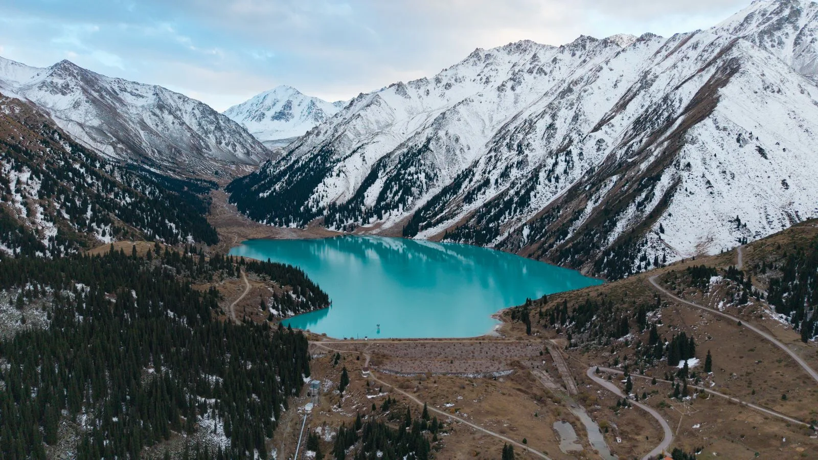
A trip to Lesotho means a mountain kingdom completely surrounded by South Africa, whose whole territory lies above 1,000 m (3,281 ft). People come for the highlands, waterfalls, hiking and pony trekking, and Basotho culture. This Lesotho travel guide gathers entry rules, the official climate of Maseru and safety advice from the UK and US governments, checked on 12 November 2026.
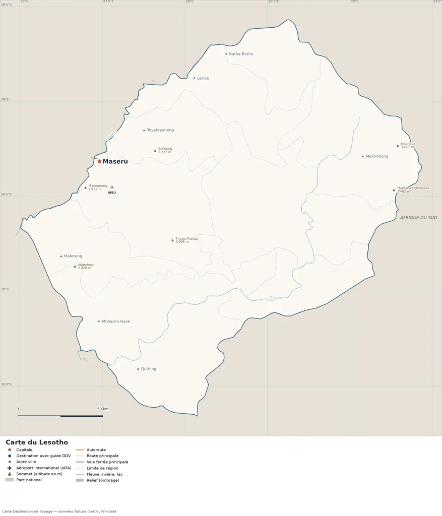
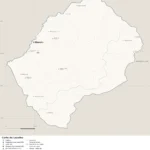
To locate cities, regions, terrain, national parks and airports, see our map of Lesotho.
Our travel deals for Lesotho
Affiliate links: we earn a commission, at no extra cost to you.
FlightsKiwi.comCompare flights and airline combinations to Lesotho.
Lesotho: what the UK and US governments say before you go
UK FCDO (GOV.UK, updated 10 December 2025): no area is listed as one the FCDO advises against. It reports gun crime between organized crime groups, opportunistic street and vehicle crime, very high gender-based violence, and poor driving standards and road conditions.
U.S. Department of State: Level 2, Exercise Increased Caution (travel advisory dated June 16, 2026), because of crime and health: armed robberies and carjackings happen from time to time, and the health infrastructure is inadequate.
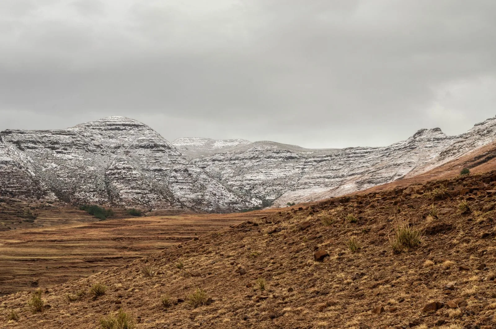
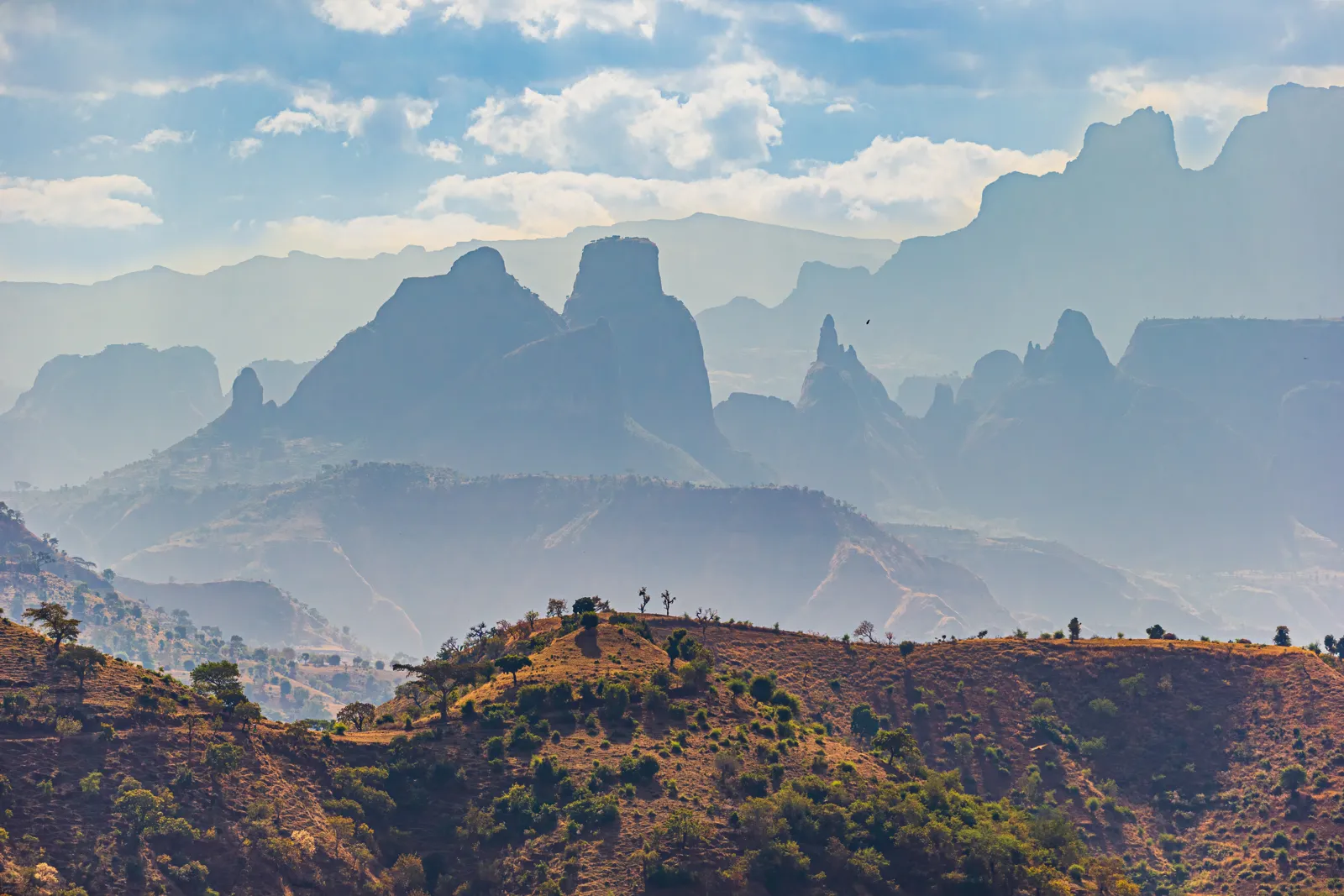
Lesotho covers 30,355 km² (11,720 sq mi). Its lowest point, at 1,400 m (4,593 ft), is the highest lowest point of any country in the world, and more than 80% of the country is above 1,800 m (5,906 ft). The direct consequences are cold winter nights, snow on the passes and demanding mountain roads.
Lesotho in figures (Destination de Voyage calculation)
Time difference: UTC+2 all year: 2 h ahead of London and 7 h ahead of New York in winter, 1 h and 6 h in summer.
Driest month in Maseru: July (5.7 mm / 0.2 in); wettest: January (121.7 mm / 4.8 in).
Warmest month: January (28.7 °C / 84 °F average high); coldest: July (−0.5 °C / 31 °F average low).
Day–night gap: up to 17.4 °C in July, against 13.0 °C in February.
Day length: from 10 h 17 min (15 June) to 14 h 01 min (15 December), a difference of 3 h 44 min.
Destination de Voyage calculation using the 1981–2010 normals of the Lesotho Meteorological Services (WMO) and the NOAA solar algorithm. Method: driest and warmest months read from the official Maseru-Mejametalana station normals shown below; day–night gap = average high minus average low.
Lesotho at a glance
CapitalMaseru
LanguageSesotho and English (official languages)
Currencythe loti (LSL), pegged one-to-one to the South African rand; both are accepted throughout the country (FCDO) · currency converter
Time zoneUTC+2 all year, no daylight saving · time difference2 h ahead of London and 7 h ahead of New York in winter; 1 h and 6 h in summerLocal time now: –:–
AirportsAll visitors must travel through South Africa, by air or by land (FCDO)Check current routes with the airlines
EntryUK: up to 90 days visa-free; US: up to 180 days visa-free; both must also meet South Africa’s entry rules · travel.state.gov · GOV.UK
Electricitywe could not check plug types and voltage against an official source: check before you travel and bring a universal adapter
Safetyhigh crime rate; no minibus taxis, no driving after dark
When to go to Lesotho
The best periods are southern autumn (March to May) and spring (September–October): in Maseru, days stay mild (19.7 to 25.7 °C / 67 to 78 °F in the afternoon in March–May, 23.3 to 24.8 °C / 74 to 77 °F in September–October) and rainfall is moderate. Summer (November to February) is the rainy season: 81 to 122 mm (3.2 to 4.8 in) per month in Maseru, mostly as thunderstorms. The US State Department notes that Lesotho has one of the highest rates of lightning strikes per square mile in the world and that lightning deaths are not uncommon: shelter in a building or car in a storm.
Winter (June to August) is dry and sunny but cold: the average low falls to −0.5 °C (31 °F) in July in Maseru, one of the lowest stations in the country. The US State Department advises visitors to the interior to bring clothing and equipment suited to extreme cold from June to August, adds that weather can deteriorate rapidly in the mountains, that snow may close mountain passes, and that temperatures can drop below freezing even in the lowlands.
Month
High °C (°F)
Low °C (°F)
Rain mm (in)
Rain days
Day–night gap (°C)
Sunrise / sunset on the 15th
Day length
January
28.7 (84)
14.8 (59)
122 (4.8)
12.0
13.9
05:24 / 19:13
13 h 49 min
February
27.6 (82)
14.6 (58)
92 (3.6)
10.0
13.0
05:51 / 18:56
13 h 06 min
March
25.7 (78)
12.5 (54)
86 (3.4)
10.0
13.2
06:10 / 18:27
12 h 17 min
April
22.9 (73)
8.6 (47)
47 (1.9)
7.0
14.3
06:28 / 17:51
11 h 23 min
May
19.7 (67)
3.7 (39)
26 (1.0)
4.0
16.0
06:46 / 17:26
10 h 40 min
June
16.7 (62)
0.2 (32)
12 (0.5)
2.0
16.5
07:02 / 17:18
10 h 17 min
July
16.9 (62)
-0.5 (31)
6 (0.2)
1.0
17.4
07:03 / 17:29
10 h 26 min
August
19.7 (67)
2.4 (36)
18 (0.7)
2.0
17.3
06:43 / 17:46
11 h 03 min
September
23.3 (74)
6.9 (44)
16 (0.6)
3.0
16.4
06:08 / 18:02
11 h 54 min
October
24.8 (77)
10.1 (50)
62 (2.4)
8.0
14.7
05:33 / 18:19
12 h 46 min
November
26.3 (79)
11.9 (53)
73 (2.9)
8.0
14.4
05:07 / 18:42
13 h 35 min
December
27.9 (82)
13.4 (56)
81 (3.2)
10.0
14.5
05:04 / 19:05
14 h 01 min
Temperatures, rainfall and rainy days: 1981–2010 normals for Maseru-Mejametalana station, Lesotho Meteorological Services, published by the World Meteorological Organization (World Weather Information Service). Sunrise, sunset and day length: Destination de Voyage calculation using the NOAA solar algorithm (15th of each month, 2027).
Our calculation from these normals: the gap between the average high and low reaches 17.4 °C in July and exceeds 16 °C from May to September. A winter day at 17 °C (63 °F) can therefore be followed by a night below freezing: pack warm layers even when the sun is shining. Daylight lasts about 10 h 15 min in June and 14 h in December.
For hiking and waterfalls: March–April (flow still strong after the rains, fewer thunderstorms) or October.
To avoid snow on the passes: avoid June to October at altitude, or check weather bulletins before each trip.
For green landscapes: December to February, accepting afternoon thunderstorms and hiking near shelter.
Where to go in Lesotho: the highlights
In short: in Lesotho you visit Thaba Bosiu, Semonkong and the Maletsunyane Falls, Malealea on horseback, the Katse Dam and the east of the country (Sehlabathebe, Sani Pass), with Maseru as the arrival point.
Maseru
The capital, on the South African border, is above all a city of arrival and supplies. The US State Department urges extra caution walking through downtown Maseru, both at night and during the day, and the UK FCDO advises against walking alone in isolated areas or after dark.
Thaba Bosiu
This fortified plateau, not far from Maseru, was the capital of King Moshoeshoe I, founder of the Basotho nation, in the 19th century. It is the most symbolic place in the country’s history.
Semonkong and the Maletsunyane Falls
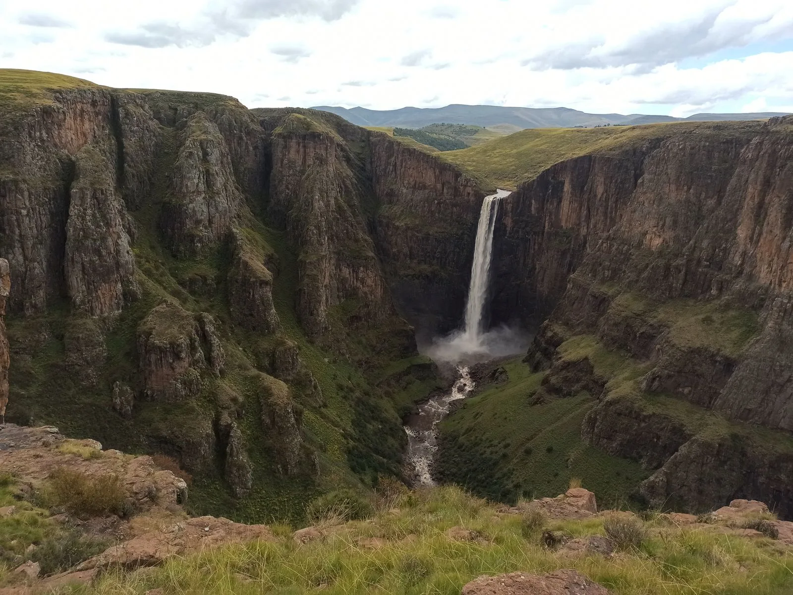
In the mountains of the center, the village of Semonkong is the starting point for the Maletsunyane Falls, which plunge into a deep gorge. The area is explored on foot or on horseback, with a local guide.
The village of Malealea, in the west of the country, is known for pony trekking on Basotho ponies and for village stays. If you camp, tell the village chief you are there.
The Katse Dam and the highlands
In the heart of the Maloti, the Katse Dam is part of a vast water project that supplies South Africa. The road there crosses high passes: check the weather before you leave, especially from June to October.
Sehlabathebe and the Sani Pass
In the east, Sehlabathebe National Park is part of the transboundary Maloti-Drakensberg World Heritage Site. Further north, the Sani Pass is a mountain track linking Lesotho to South Africa’s KwaZulu-Natal: check the condition of the track, the vehicle required and the opening hours of the border post, published by the Lesotho customs authorities.
A landlocked kingdom at altitude
Lesotho is one of three states in the world entirely enclosed by a single other country, with San Marino and the Vatican: it is surrounded on all sides by South Africa, and its lowest point is at 1,400 m (4,593 ft). Every arrival in Lesotho therefore goes through a South African border post (the FCDO says all visitors must travel through South Africa), and the climate is a mountain one: cold nights, possible snow on the passes from June to October, violent thunderstorms in summer.
The Sani Pass illustrates this: this gravel track links KwaZulu-Natal to the Mokhotlong district, climbing from 1,544 m (5,066 ft) to 2,876 m (9,436 ft), with gradients of up to 1 in 3. South Africa generally admits only 4×4 vehicles, and the track can be snowy or icy in winter (Wikipedia). Check the track condition and the border post hours before committing.
Landmark
Value
Source
Area
30,355 km² (11,720 sq mi)
Wikipedia (EN), « Lesotho »
Lowest point
1,400 m (4,593 ft), the highest lowest point of any country
Wikipedia (EN), « Lesotho »
Territory above 1,800 m (5,906 ft)
More than 80%
Wikipedia (EN), « Lesotho »
Sani Pass
From 1,544 m to 2,876 m (5,066 to 9,436 ft); generally 4×4 only on the South African side
Wikipedia (EN), « Sani Pass »
World Heritage
Sehlabathebe park, in the transboundary Maloti-Drakensberg site
UNESCO World Heritage Centre
Destination de Voyage summary, sources checked on 11 November 2026.
One week: Maseru and Thaba Bosiu; Malealea (2 nights); Semonkong and the Maletsunyane Falls (2 nights); return to Maseru.
Ten days to two weeks: same start, then Katse and the highlands, Sehlabathebe or the Sani Pass depending on the season, and exit to South Africa.
Combining with South Africa: this is the most common option (see our South Africa guide). Note the US State Department’s warning that it is common for foreigners residing in Lesotho to receive seven-day visas when crossing into South Africa by road, and that overstaying in South Africa can lead to being barred: check South Africa’s rules before you go.
Budget
We do not publish a budget range, for lack of an official source on prices. Two items should be planned for: a rental car suited to the mountains (both governments advise against local minibus taxis) and insurance that covers medical evacuation, since the FCDO says Lesotho has basic medical facilities and most foreign visitors use facilities in Bloemfontein, South Africa.
Getting around Lesotho
In short: in Lesotho the safest option is a rental car suited to the mountains, driven by day, or transport arranged by your accommodation or a tour operator.
The UK FCDO says driving standards and road conditions are poor, that animals roaming the roads are a hazard, especially at night, and that local minibus taxis (« 4+1s ») may be poorly maintained and uninsured: avoid them. It advises driving in daylight, keeping doors locked and windows shut, not stopping if people flag you down and not giving lifts to strangers. The US State Department says the majority of Lesotho’s roads are unpaved, that driving after dark is dangerous because of the absence of street lighting, livestock on the roads and carjackings, and that public transport is unsafe. Traffic drives on the left, as in South Africa and the UK. A UK photocard licence can be used for up to 3 months (FCDO).
If you rent a car in South Africa, tell the rental company you plan to enter Lesotho. At the borders, make sure your passport is stamped on both sides: the FCDO says you need at least 4 blank pages for stamps, because both Lesotho and South African border control stamp your passport.
Where to stay
Hotels in Maseru, lodges and guesthouses in mountain villages (Semonkong, Malealea), and camping on treks. For wild camping, tell the village chief you are there rather than pitching unannounced.
Entry requirements for Lesotho
US citizens
According to the U.S. Department of State (travel.state.gov, last updated September 24, 2026), you need a valid passport. Visas are not required for stays of 180 days or fewer; US citizens are generally granted 30 days at the border and may apply for an extension up to 180 days through the Office of Immigration at the Ministry of Home Affairs.
The State Department says yellow fever vaccination is a common requirement throughout the region and recommends carrying your international vaccination card, and notes that Lesotho government websites are often outdated, so contact the Immigration Office directly. For South Africa, you need two blank (unstamped) visa pages to visit or transit.
UK citizens
According to the UK FCDO (GOV.UK foreign travel advice, updated 10 December 2025), you can visit Lesotho for up to 90 days without a visa. Your passport must be valid for at least 90 days after arrival and you need at least 4 blank pages for stamps.
To extend your stay, complete the 90-day temporary permit extension form and take it to the Visa Application Centre at the Manthabiseng Convention Centre in Maseru. If you overstay without permission, the authorities may detain you and charge weekly fines.
Declare cash or travellers cheques of 25,000 loti or more in any currency, or the money could be seized when you leave.
The two governments give different lengths of visa-free stay (90 days for UK citizens, 180 days for US citizens, with 30 days usually granted at the border): confirm with the Lesotho Immigration Office or your nearest Lesotho embassy or high commission before you travel. Entry requirements checked on 12 November 2026. See also our entry requirements guide.
Health and safety
Health: check vaccine recommendations at least 8 weeks before your trip (FCDO; TravelHealthPro). Altitude sickness is a risk in parts of Lesotho (FCDO and State Department). According to the Institut Pasteur, there is no malaria transmission and no malaria prophylaxis is recommended. In Maseru, tap water is potable (State Department).
Care: Lesotho has basic medical facilities; most foreign visitors use facilities in Bloemfontein, South Africa, a 90-minute drive from Maseru (FCDO). The main hospitals are Queen Mamohato Memorial Hospital and Maseru Private Hospital. Emergency number: 112 (FCDO).
Crime: Lesotho has a high crime rate; foreigners are frequently targeted and robbed, and have been carjacked and killed (State Department). Do not walk alone in isolated areas or after dark; if attacked, do not resist (FCDO).
Laws: sexual activity between men is illegal, although the FCDO is not aware of it being enforced. Drug possession is a serious offense. Carry a copy of your passport photo page and entry stamp.
Protected species: do not buy items made from protected plants such as the spiral aloe (Aloe polyphylla), whose trade is prohibited (see the Lesotho customs authorities).
Practical tips for Lesotho
Money: UK debit and credit cards are widely accepted for payment and at ATMs, but outside Maseru take enough cash for local purchases (FCDO). South African rand are accepted alongside the loti.
Internet: check your carrier’s roaming rates before you go. A local SIM or an eSIM is more practical (see our eSIM guide).
Weather: check the forecast before any mountain trip, and tell your accommodation or a local contact your plans before a long trek.
Etiquette: the Basotho blanket and the mokorotlo hat are national symbols; ask before photographing people.
Scams: the State Department warns that internet romance and financial scams are prevalent.
Common mistakes to avoid
Forgetting that every journey to Lesotho goes through South Africa, whose entry rules also apply.
Assuming the Lesotho and US/UK visa-free periods are the same: they are not (see above).
Renting a car in South Africa without telling the rental company about the Lesotho crossing.
Driving at the end of the day to « save time »: driving after dark is dangerous.
Hiking in summer without spotting a shelter from lightning, or in winter without checking snow on the passes.
Forgetting to get your passport stamped on both sides of the border.
Verified practical information
Topic
Information
Source (consulted 11–12 November 2026)
Currency
Loti (LSL), issued by the Central Bank of Lesotho, pegged 1:1 to the South African rand (common monetary area); the rand is also accepted
UK FCDO; Central Bank of Lesotho; Wikipedia (EN), « Lesotho loti »
Electricity
Not verified against an official source: check plug types and voltage before you travel
n/a
Languages
Sesotho and English, official languages
Wikipedia (EN), « Lesotho »
Health
No malaria transmission, no prophylaxis; altitude sickness is a risk in parts of the country
Institut Pasteur, Lesotho sheet; UK FCDO; U.S. Department of State
Safety
US Level 2, Exercise Increased Caution (June 16, 2026); no FCDO warning against travel to a specific area
U.S. Department of State; UK FCDO (GOV.UK, 10 December 2025)
Time
UTC+2 all year
Our time difference page
Destination de Voyage table, information checked on 12 November 2026.
Frequently asked questions
Do you need a visa for Lesotho?
Not for a short visit. According to the UK FCDO, British citizens can stay up to 90 days without a visa; according to the US State Department, US citizens do not need a visa for 180 days or fewer (30 days are generally granted at the border). Both must also meet South Africa’s entry rules.
Is Lesotho dangerous?
The US State Department rates Lesotho Level 2, Exercise Increased Caution, because of crime and health, and the UK FCDO lists no area to avoid. The main risks are crime, roads and mountain weather.
What language is spoken in Lesotho?
Sesotho and English, the two official languages.
What is the best time to visit Lesotho?
March to May and September–October: mild days, moderate rainfall, fewer thunderstorms than in summer and less risk of snow than in midwinter.
Can you pay in rand in Lesotho?
Yes: the loti is pegged one-to-one to the South African rand, and both currencies are accepted throughout Lesotho (FCDO).
Where is Lesotho?
In southern Africa: it is a kingdom completely surrounded by South Africa.
What is the capital of Lesotho?
Maseru, on the South African border, in the west of the country.
Why is Lesotho called a mountain country?
Because the whole country is at altitude: its lowest point is at 1,400 m (4,593 ft), the highest lowest point of any country, and more than 80% of its territory is above 1,800 m (5,906 ft).
Is there malaria in Lesotho?
No: the Institut Pasteur indicates no malaria transmission and no malaria prophylaxis.
What is the time difference with Lesotho?
Lesotho is on UTC+2 all year: 2 h ahead of London and 7 h ahead of New York in winter, 1 h and 6 h in summer.
Can you drive the Sani Pass in a rental car?
Only with a suitable vehicle: South Africa generally admits only 4x4s on this track, which climbs to 2,876 m (9,436 ft) and can be snowy in winter. Also tell the rental company you are entering Lesotho.
Is it cold in Lesotho?
In winter, yes: in Maseru the average low is −0.5 °C (31 °F) in July, and the US State Department says snow may close mountain passes and temperatures can fall below freezing even in the lowlands.
U.S. Department of State, Lesotho country information (travel.state.gov, last updated September 24, 2026) and Travel Advisory (Level 2, June 16, 2026), read on 12 November 2026
World Meteorological Organization, World Weather Information Service: 1981–2010 normals for Maseru-Mejametalana (Lesotho Meteorological Services)
Astronomical calculation by Destination de Voyage using the NOAA solar algorithm


 FlightsKiwi.comCompare flights and airline combinations to Lesotho.Compare flights