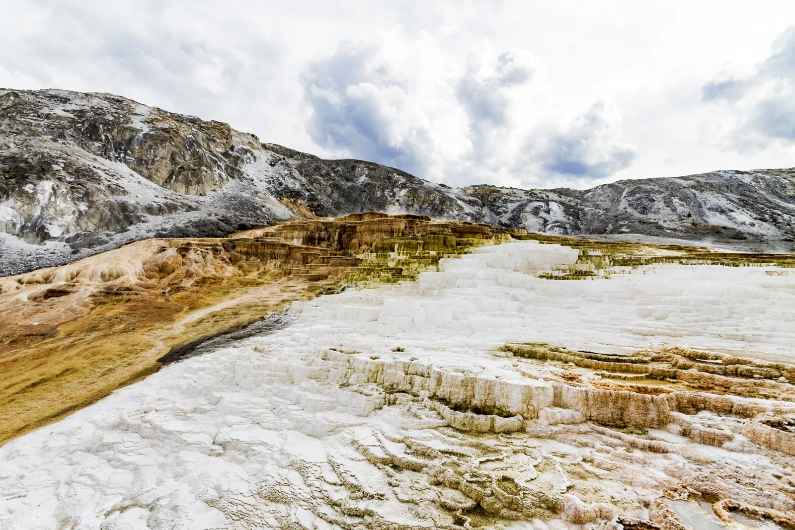
Death Valley is the hottest and driest national park in North America: it spans California and Nevada and drops to 86 meters (282 ft) below sea level at Badwater. The park is open all year, 24 hours a day; entry costs $30 per vehicle for 7 days, by card only. The best season runs from November to March: in July, the average maximum reaches 47.4 °C (117 °F) at Furnace Creek. This page brings together the official fees, the road status recorded on the day of writing, the month-by-month climate normals, sunrise and sunset times and the safety rules for visiting Death Valley without taking risks.
Death Valley is almost always visited as part of a road trip in the American West: see our California travel guide, our page on the best time to visit California and our Las Vegas guide, the nearest big city on the Nevada side.

Our travel deals for Death Valley
Affiliate links: we earn a commission, at no extra cost to you.
 FlightsKiwi.comCompare flights and airline combinations to Death Valley.Compare flights
- eSIMAiraloData plan to install before you leave (eSIM-compatible phone).See plans


Death Valley: key facts
- Opening: all year, 24 h a day; some roads and facilities close depending on the season or the weather — checked on 24 October 2026 on nps.gov
- Entry: $30 per private vehicle, $25 per motorcycle, $15 per person on foot or by bicycle (free under 16); valid 7 days — checked on 24 October 2026 on nps.gov
- Payment: the park does not accept cash (« This park does not accept cash »): bank card only
- Annual pass for non-residents: America the Beautiful « Non-Resident Annual Pass » at $250, valid at federal sites
- Getting there: no public transport to or within the park; no cell coverage on most roads
- Entry requirements: see entry requirements for the United States
Why visit Death Valley?
The National Park Service describes Death Valley as the hottest place on the planet and the driest in North America. The world record for air temperature, 134 °F (57 °C), was measured there at Furnace Creek on July 10, 1913. The valley is a long, narrow basin hemmed in by high mountain ranges: the dry air and sparse vegetation let the sun heat the ground, and the heat stays trapped at the bottom of the valley. Four mountain ranges separate it from the Pacific, creating a « rain shadow »: on average less than 5 cm (2 in) of rain falls there per year.
These extremes make the spectacle: salt flats below sea level, eroded hills in mineral colors, canyons and roads built in the 1930s. They also demand serious preparation, which this page details.
The main sights of Death Valley
The NPS points out that most of the famous sites can be seen by car. Here are those cited by the park’s official pages, from south to center:
- Badwater Basin: the bottom of the valley, 282 feet (86 m) below sea level, at the end of Badwater Road.
- Devils Golf Course and Artists Drive: reached from the same Badwater Road, as is Ashford Mill farther south.
- Zabriskie Point: a viewpoint where you can also buy your entry fee (card kiosk).
- Furnace Creek: main visitor center, fuel, lodging and camping.
- Stovepipe Wells: ranger station, fuel (no diesel), camping and electric charging stations.
The park also offers ranger programs, hikes, night-sky viewing and tracks for suitable vehicles. For a longer trip, compare with our guides to the Grand Canyon and Monument Valley.
Road status: what was closed on October 23, 2026
Flash floods regularly change access to the park. According to the NPS « Alerts & Conditions » page, updated on October 23, 2026 — checked on 24 October 2026 on nps.gov:
- North Highway and Beatty Cut-off: closed after flooding and debris from a storm on October 22.
- Badwater Road: caution, debris on the roadway after the October 22 floods.
- Scotty’s Castle and Bonnie Clare Road: closed for flood repair work, with no reopening date, including for pedestrians.
- Titus Canyon Road: closed for repairs, reopening expected in May 2027.
- Westside Road: closed after the October 22 damage; the Darwin Falls road destroyed in places.
This list changes fast: check the official conditions page the day before and on the morning itself. The NPS specifies that closures apply to all motor vehicles, motorcycles included.
Death Valley climate month by month
The normals below are for the Furnace Creek station, in the heart of the valley. At altitude, the NPS says the temperature drops by 2 to 3 °C (about 4 to 5 °F) for roughly every 300 meters (1,000 ft).
| Month | Avg. max | Avg. min | Rain | Verdict |
|---|---|---|---|---|
| January | 19.6 °C (67 °F) | 5.8 °C (42 °F) | 9.4 mm (0.4 in) | ✅ ideal |
| February | 23.2 °C (74 °F) | 9.4 °C (49 °F) | 13.2 mm (0.5 in) | ✅ ideal |
| March | 28.1 °C (83 °F) | 13.9 °C (57 °F) | 6.3 mm (0.2 in) | ✅ ideal |
| April | 32.8 °C (91 °F) | 18.2 °C (65 °F) | 2.5 mm (0.1 in) | ⚠️ hot |
| May | 38.2 °C (101 °F) | 23.9 °C (75 °F) | 0.8 mm (<0.1 in) | ❌ extreme heat |
| June | 43.9 °C (111 °F) | 28.9 °C (84 °F) | 1.3 mm (0.1 in) | ❌ extreme heat |
| July | 47.4 °C (117 °F) | 32.8 °C (91 °F) | 2.5 mm (0.1 in) | ❌ extreme heat |
| August | 46.6 °C (116 °F) | 31.5 °C (89 °F) | 2.5 mm (0.1 in) | ❌ extreme heat |
| September | 42.1 °C (108 °F) | 26.2 °C (79 °F) | 5.1 mm (0.2 in) | ❌ extreme heat |
| October | 34.1 °C (93 °F) | 18.0 °C (64 °F) | 3.0 mm (0.1 in) | ⚠️ hot |
| November | 25.2 °C (77 °F) | 10.3 °C (51 °F) | 2.5 mm (0.1 in) | ✅ ideal |
| December | 18.7 °C (66 °F) | 5.1 °C (41 °F) | 6.6 mm (0.3 in) | ✅ ideal |
Even in the wettest month, February, barely more than 13 mm (0.5 in) of rain falls on average. From June to August, minimum temperatures stay around 29 to 33 °C (84 to 91 °F): the night brings almost no relief. To place Death Valley in an itinerary, see our page on the best time to visit California.
Sunrise and sunset at Furnace Creek
The low light of morning and evening brings out the relief, and it is also the only cool moment in summer. The NPS even devotes a page to the best viewpoints for sunrise and sunset.
| Month | Sunrise | Sunset | Day length |
|---|---|---|---|
| January | 06:58 | 16:55 | 9 h 57 |
| February | 06:35 | 17:28 | 10 h 53 |
| March | 06:58 | 18:54 | 11 h 56 |
| April | 06:13 | 19:21 | 13 h 08 |
| May | 05:40 | 19:47 | 14 h 07 |
| June | 05:28 | 20:07 | 14 h 38 |
| July | 05:41 | 20:05 | 14 h 24 |
| August | 06:05 | 19:38 | 13 h 33 |
| September | 06:29 | 18:54 | 12 h 25 |
| October | 06:54 | 18:11 | 11 h 17 |
| November | 06:24 | 16:38 | 10 h 14 |
| December | 06:51 | 16:33 | 9 h 41 |
In December, the day lasts less than 10 hours: set out early if you are crossing the park in a day. In June, the sun rises around 5:30 am and sets around 8 pm: do your walks at dawn and spend the middle of the day in an air-conditioned car or in the shade.
Safety: heat, roads and no cell coverage
According to the NPS, the most frequent danger in Death Valley is not the heat but the single-vehicle car accident, often a rollover: the 1930s roads are narrow and winding. The park also reminds visitors that help may be hours away and that you must travel « prepared to rescue yourself » — checked on 24 October 2026 on nps.gov.
- Fuel: three stations in the park, at Furnace Creek (gasoline and diesel), Panamint Springs (gasoline and diesel) and Stovepipe Wells (87 gasoline only).
- Electric car: no fast charging in the park; the nearest is in Beatty (Nevada), 43 miles (69 km) from Furnace Creek according to the NPS.
- GPS: the NPS warns against GPS navigation, often wrong for remote places; carry an up-to-date paper map and download the NPS app for offline use.
- Dirt roads: from April to mid-October, driving off paved roads requires water, spare parts and experience; driving off permitted roads is forbidden.
- Water: carry much more water than usual, in the car as for the shortest walk.
Entry requirements and preparation
For passport, visa and ESTA rules, see entry requirements for the United States.
Car rental and activities: how to book
With no public transport, a car is essential, unless you take an organized excursion from Las Vegas. Compare rental companies by checking what matters here: air conditioning, mileage, permission to drive on dirt roads (often excluded from contracts), assistance in areas with no coverage. For excursions, check whether the park entry fee is included and which stops are planned, given the closed roads. Ranger programs can be found on the NPS website.
Decision tree: when and how to visit Death Valley?
- You are traveling from November to March: the best season; plan at least one night on site to enjoy the sunrise.
- You are passing through in April or October: doable, with maximums of 33 to 34 °C (91 to 93 °F); walk early in the morning.
- You are passing through from May to September: cross in an air-conditioned car, make short stops near the vehicle, no hiking in the middle of the day.
- You are driving an electric car: plan the charging before you enter, there is no fast charger in the park.
- You want to take a dirt road: check the conditions page first, then the rental contract.
Common mistakes to avoid
- Arriving with cash to pay the entry fee: the park is cashless.
- Relying on GPS alone: the NPS expressly advises against it.
- Setting off without filling up: the park’s stations are few.
- Planning Titus Canyon or Scotty’s Castle without checking: they were closed on October 23, 2026.
- Counting on your phone: it has no signal on most of the park’s roads.
What to see nearby
Death Valley combines with Las Vegas, Los Angeles or San Francisco in the same road trip; our road trip guide helps you prepare it, and our travel eSIM guide helps you stay reachable outside the park. For a US data plan, also read eSIM for the USA: compatibility and installation.
Frequently asked questions
How much does it cost to enter Death Valley?
$30 per private vehicle, $25 per motorcycle and $15 per pedestrian or cyclist aged 16 and over, for 7 days, according to the National Park Service website consulted on 24 October 2026. Payment by card only.
Is Death Valley open at night?
Yes, the park is open all year, 24 hours a day. Some roads and facilities have seasonal hours or close in dangerous weather.
What is the best time to visit Death Valley?
From November to March, when average maximums stay between 18.7 and 28.1 °C (66 and 83 °F) at Furnace Creek (NOAA 1991–2020 normals). In July, the average reaches 47.4 °C (117 °F).
Can you visit Death Valley in summer?
Yes, but in an air-conditioned car, with plenty of water, short stops and no hiking during the day. Minimum temperatures exceed 29 °C (84 °F) in July.
Is there cell coverage in Death Valley?
Not on most of the park’s roads, according to the NPS. Wi-Fi is only available for purchase at Furnace Creek. Download maps and the app before entering.
Do you need to book to enter Death Valley?
The NPS mentions no entry reservation: the entry fee is bought online on Recreation.gov or at the park’s kiosks, by card.
Our sources
- National Park Service, Death Valley (nps.gov/deva): Fees & Passes, Operating Hours, Directions, Alerts & Conditions (updated October 23, 2026), Weather and Things to do pages, consulted on 24 October 2026
- NOAA, 1991–2020 normals for the Death Valley station (Furnace Creek), via the Wikipedia article « Death Valley » (NOAA NOWData source), consulted on 24 October 2026
- Astronomical calculations: NOAA solar algorithm, applied by Destination de Voyage to the coordinates of the Furnace Creek visitor center published by the NPS (15th of each month, year 2027, clear horizon)
- Our methodology
Updated November 2026. Prices, hours and access conditions may change: check the official website before you go.