The Grand Canyon, carved by the Colorado River in northern Arizona, is the most famous national park in the United States: 446 km (277 mi) long, up to 1,800 m (5,900 ft) deep, with rock layers that tell nearly two billion years of geological history. This guide to visiting the Grand Canyon compares the South Rim and the North Rim and covers the viewpoints and hikes, the best time to go according to official NOAA normals, the 2026 entrance fees and a trap few guides explain: the time in Arizona.

Our travel deals for Grand Canyon
Affiliate links: we earn a commission, at no extra cost to you.
 FlightsKiwi.comCompare flights and airline combinations to Grand Canyon.Compare flights
- eSIMAiraloData plan to install before you leave (eSIM-compatible phone).See plans


Grand Canyon at a glance
- Location northern ArizonaAbout 4 h 30 min by road from Las Vegas and 3 h 30 min to 4 h from Phoenix to the South Rim
- Language English
- Currency US dollar (USD); cards accepted everywhere · currencies
- Time zone UTC−7 all year: 7 hours behind London in winter, 8 in summer · detailsArizona does not observe daylight saving time (see below and our page on time differences in the United States)Local time now: –:–
- Airports Phoenix Sky Harbor (PHX) and Las Vegas Harry Reid (LAS) · detailsFlagstaff has a small regional airport; check current routes from your home airport
- Entry US citizens: domestic travel; UK citizens: approved ESTA or US visa before travel · UK: GOV.UK
- Electricity check voltage and plug types before you leave · plugs
- 2026 entrance fees $35 per vehicle(7 days) + $100 per non-US resident aged 16 and over, unless entering with an annual pass (NPS)
- Ideal length 1 to 2 days on the South Rim · details
- Best time mid-April to early June and mid-September to mid-October
South Rim or North Rim? The comparison
The two rims are only about fifteen kilometers (10 mi) apart as the crow flies, but it takes about 350 km (217 mi) and 4 h 30 min by road to get from one to the other. Most visitors only see the South Rim.
| Criterion | South Rim | North Rim |
|---|---|---|
| Altitude | About 2,100 m (6,900 ft) | About 2,500 m (8,200 ft) |
| Opening | All year | Seasonal; limited access in 2026 after the 2025 fire |
| July high (NOAA) | 29.4 °C (85 °F) | 25.1 °C (77 °F) |
| January low (NOAA) | −7.1 °C (19 °F) | −7.8 °C (18 °F) |
| Annual snowfall (NOAA) | about 109 cm (43 in) | about 321 cm (126 in) |
| Crowds | Very high | Much lower |
| Access | Las Vegas, Phoenix, Flagstaff, Williams | Utah (Kanab), Route 67 from Jacob Lake |
| Services | Villages, hotels, free shuttles | None in fall 2026 |
Important for 2026: the Dragon Bravo Fire, sparked by lightning in July 2025, burned a large area of the North Rim and destroyed buildings there. According to the National Park Service (current conditions, updated 26 October 2026), the North Rim is limited to fall day use only, with no services (campground, store and gas station closed), and its scenic roads are closed for repairs through November 3: check what is accessible before planning this detour.
Our decision tree
- You only have one day or are traveling between November and mid-May → the South Rim, without hesitation.
- You are doing a round trip from Las Vegas → the South Rim via Williams, or Grand Canyon West if you want the Skywalk (outside the national park, run by the Hualapai Tribe).
- You are doing a loop with Utah (Zion, Bryce, Page) between June and September → the North Rim can fit in, if it is accessible that year.
- You want to hike to the bottom of the canyon → from the South Rim (Bright Angel or South Kaibab), with a Phantom Ranch reservation or a backcountry camping permit.
- You are looking for peace and quiet → Desert View and the Hermit Road viewpoints early in the morning, rather than Mather Point.
What to see on the South Rim of the Grand Canyon
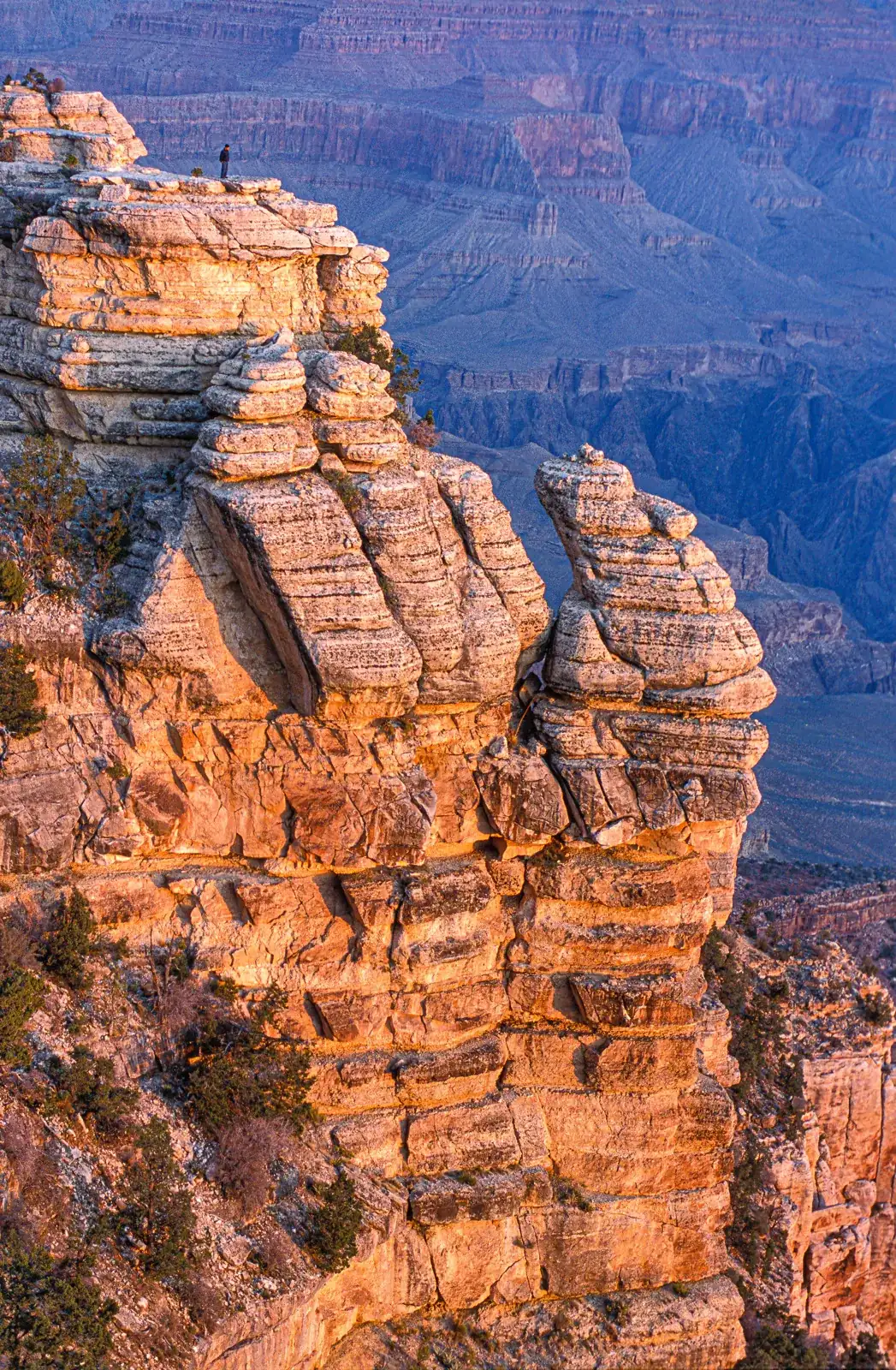
Mather Point and the visitor center
The first view for most visitors, a few minutes’ walk from the visitor center. The panorama takes in a large part of the canyon. Very busy at sunrise and sunset.
The Rim Trail
This flat, partly paved trail follows the edge for about twenty kilometers (13 mi), from the South Kaibab Trailhead to Hermits Rest. Walk it in sections, returning by shuttle. The Mather Point – Yavapai Point – village section is the easiest. The Yavapai Geology Museum explains how the canyon formed.
Hermit Road
An 11 km (7 mi) road heading west, closed to private vehicles for much of the year: the free shuttle (Red Route) stops at nine viewpoints, including Hopi Point and Mohave Point, two of the best sunset spots.
Desert View Drive and the Watchtower
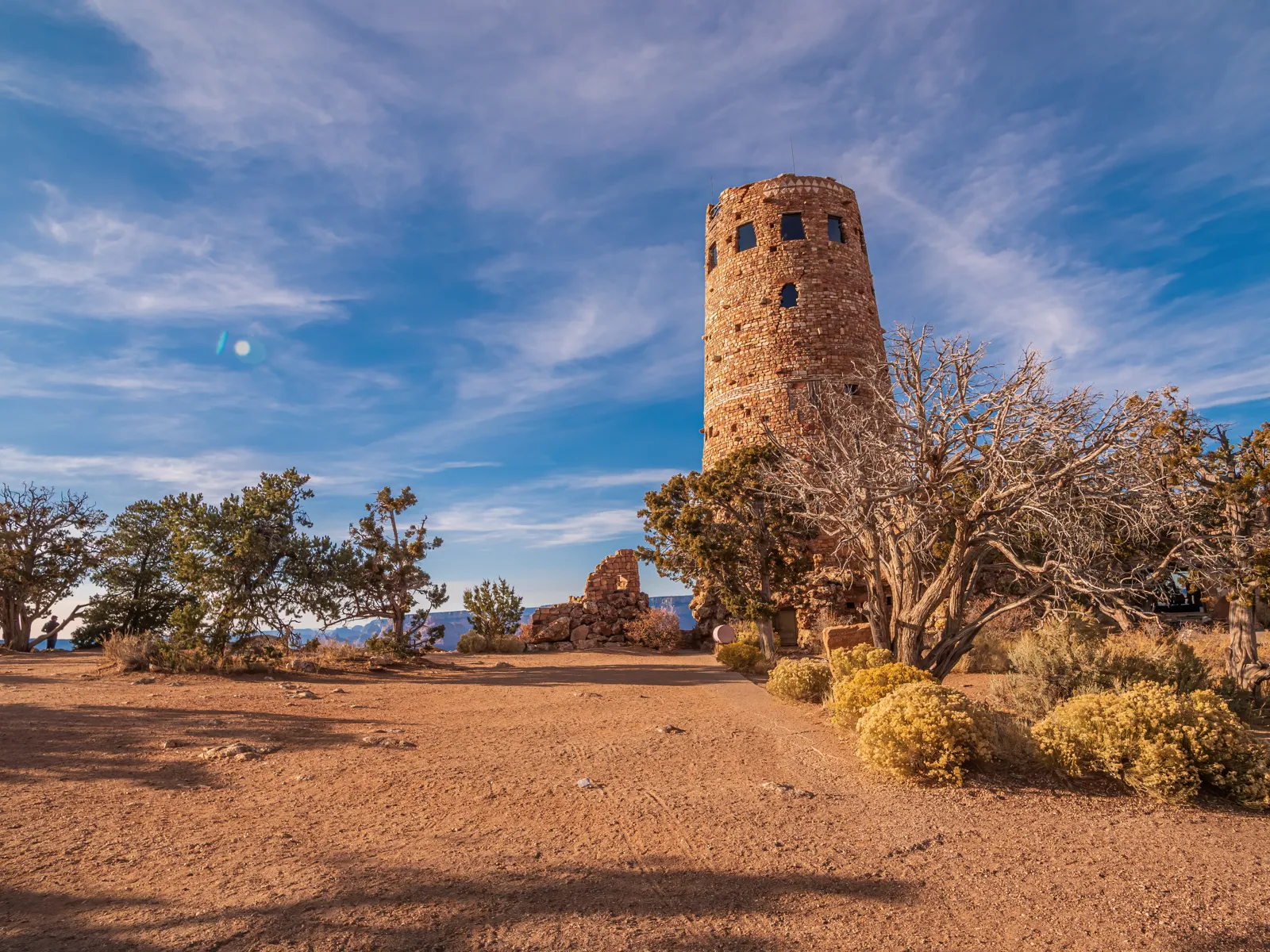
To the east, a 40 km (25 mi) road serves Grandview Point, Moran Point, Lipan Point and the Desert View Watchtower, designed by architect Mary Colter, from which you can see the Colorado River. The East Entrance at Desert View is open 24 hours a day, 7 days a week, according to the NPS (nps.gov).
Grand Canyon Village
The historic village brings together El Tovar, Bright Angel Lodge, Hopi House and Kolb Studio, as well as the station of the Grand Canyon Railway, a scenic train from Williams.
Hiking into the canyon
The Bright Angel Trail and the South Kaibab Trail descend toward the Colorado. NPS rangers advise against attempting a round trip to the river in a single day. For a first taste, hike down to Ooh Aah Point (South Kaibab) or to the first rest house on the Bright Angel, bearing in mind that the climb back up takes about twice as long as the descent.
Grand Canyon: 7 to 12 °C (13 to 21 °F) hotter at the bottom than on the rim
This is hikers’ most common mistake: judging the day by the temperature on the rim. With about 1,400 m (4,600 ft) of elevation difference between the South Rim and Phantom Ranch, beside the Colorado, the bottom of the canyon has a different climate. We compared average highs at the three NOAA stations.
| Month | South Rim high | North Rim high | Bottom high, Phantom Ranch | Gap bottom − South Rim |
|---|---|---|---|---|
| January | 6.8 °C (44 °F) | 2.3 °C (36 °F) | 13.8 °C (57 °F) | +7.0 °C (+13 °F) |
| February | 7.9 °C (46 °F) | 2.9 °C (37 °F) | 17.3 °C (63 °F) | +9.4 °C (+17 °F) |
| March | 12.0 °C (54 °F) | 6.8 °C (44 °F) | 22.6 °C (73 °F) | +10.6 °C (+19 °F) |
| April | 16.1 °C (61 °F) | 11.2 °C (52 °F) | 27.2 °C (81 °F) | +11.2 °C (+20 °F) |
| May | 21.1 °C (70 °F) | 16.7 °C (62 °F) | 32.7 °C (91 °F) | +11.7 °C (+21 °F) |
| June | 27.8 °C (82 °F) | 23.0 °C (73 °F) | 38.9 °C (102 °F) | +11.1 °C (+20 °F) |
| July | 29.4 °C (85 °F) | 25.1 °C (77 °F) | 40.2 °C (104 °F) | +10.8 °C (+19 °F) |
| August | 27.8 °C (82 °F) | 23.4 °C (74 °F) | 38.3 °C (101 °F) | +10.4 °C (+19 °F) |
| September | 24.3 °C (76 °F) | 19.5 °C (67 °F) | 34.7 °C (94 °F) | +10.4 °C (+19 °F) |
| October | 18.1 °C (65 °F) | 13.1 °C (56 °F) | 27.7 °C (82 °F) | +9.6 °C (+17 °F) |
| November | 11.8 °C (53 °F) | 7.1 °C (45 °F) | 19.8 °C (68 °F) | +8.0 °C (+14 °F) |
| December | 6.1 °C (43 °F) | 2.4 °C (36 °F) | 13.3 °C (56 °F) | +7.2 °C (+13 °F) |
In July, it averages 40.2 °C (104 °F) in the afternoon at the bottom, versus 29.4 °C (85 °F) on the South Rim. From June to August, the average high at Phantom Ranch exceeds 38 °C (100 °F). The gap ranges from 7.0 to 11.7 °C (13 to 21 °F) depending on the month. If you hike down in summer, set off before dawn, climb back before 10 am, carry plenty of water and salty snacks, and follow the rangers’ daily messages.
Time at the Grand Canyon: the Arizona trap
Arizona does not observe daylight saving time: the Grand Canyon stays at UTC−7 all year. But its neighbors do change: Nevada (Las Vegas) and California follow Pacific Time, and the Navajo Nation, which covers the northeast of the state (Monument Valley, Antelope Canyon, the area around Cameron), observes Mountain daylight time. On a Las Vegas – Grand Canyon – Monument Valley loop, your phone can change time several times in one day. We calculated the actual differences for 2027. Our guide to Monument Valley, its buttes and scenic drive covers visiting the Navajo Nation.
| Period | London / Grand Canyon | New York / Grand Canyon | Las Vegas / Grand Canyon | Navajo Nation / Grand Canyon |
|---|---|---|---|---|
| January 1 to March 13, 2027 | London 7 h ahead | New York 2 h ahead | Las Vegas 1 h behind | same time |
| March 14 to 27, 2027 | London 7 h ahead | New York 3 h ahead | same time | +1 h in the Navajo Nation |
| March 28 to October 30, 2027 | London 8 h ahead | New York 3 h ahead | same time | +1 h in the Navajo Nation |
| October 31 to November 6, 2027 | London 7 h ahead | New York 3 h ahead | same time | +1 h in the Navajo Nation |
| November 7 to December 31, 2027 | London 7 h ahead | New York 2 h ahead | Las Vegas 1 h behind | same time |
- In summer (mid-March to early November), Las Vegas and the Grand Canyon share the same time, but Monument Valley is one hour ahead.
- In winter, the Grand Canyon is one hour ahead of Las Vegas and on the same time as Monument Valley.
- For a guided tour of Antelope Canyon or a sunset, ask the operator which time zone their schedule uses.
- The town of Page is not in the Navajo Nation: it stays on Arizona time, while nearby Navajo sites may be one hour ahead in summer.
To recover from your flight, see our tips against jet lag.
How to get to the Grand Canyon?
- From Las Vegas: about 450 km (280 mi) to the South Rim via Kingman and Williams, or 200 km (124 mi) to Grand Canyon West (Skywalk). The classic starting point for a road trip in the American West.
- From Phoenix: about 370 km (230 mi) via Flagstaff; Phoenix Sky Harbor is the main airport in Arizona.
- From Flagstaff or Williams: 1 h to 1 h 30 min by road; Williams is also the starting point of the Grand Canyon Railway.
- From California: a long day’s drive from Los Angeles; best built into a loop, see our California guide.
- On site: free shuttle buses on the South Rim connect visitor center lots, overlooks, trailheads and village services (NPS), avoiding the crowded parking lots.
2026 entrance fees: is the annual pass worth it?
According to the National Park Service (Fees & Passes, updated 20 July 2026, checked 26 October 2026), entry costs $35 per private vehicle, valid 7 days, and since 2026 non-US residents aged 16 and over pay an extra $100 per person. The surcharge does not apply if you enter with an America the Beautiful annual pass, sold for $250 to non-residents ($80 for US residents). We compared the two options for a car of non-US visitors.
| Travelers aged 16+ in the car | Grand Canyon entry only | America the Beautiful non-resident pass | Cheaper option for the Grand Canyon alone |
|---|---|---|---|
| 1 | $135 | $250 | Single entry |
| 2 | $235 | $250 | Single entry |
| 3 | $335 | $250 | Annual pass |
| 4 | $435 | $250 | Annual pass |
From three adults, the pass costs less than Grand Canyon entry alone. For two, the difference is only $15: if your loop also includes other national parks, the pass quickly pays off. US residents simply pay the $35 vehicle fee. Fees may change: check them on nps.gov before you go.
Itinerary ideas
The Grand Canyon in 2 days (South Rim)
- Day 1: arrive via Williams, Mather Point, the Rim Trail to the village, sunset at Hopi Point (shuttle)
- Day 2: sunrise at Yavapai Point, a short hike down the South Kaibab Trail to Ooh Aah Point, Desert View Drive heading east, exit via Desert View
A 10-day loop in the West
- Days 1-2: Las Vegas
- Days 3-4: Grand Canyon, South Rim
- Day 5: Desert View, Cameron, Page (Horseshoe Bend, Antelope Canyon)
- Day 6: Monument Valley
- Days 7-8: Bryce Canyon and Zion (Utah)
- Days 9-10: back to Las Vegas, or on to California
Other parks combine with this region, such as Colorado or, further north, Yellowstone. For a first trip, see our United States travel guide.
When to go to the Grand Canyon? Climate and best time
The best time to visit the Grand Canyon is mid-April to early June and mid-September to mid-October: 16 to 27 °C (61 to 81 °F) in the afternoon on the South Rim, cool nights, little rain. Summer is high season: pleasant on the rim (29 °C / 85 °F in July), crushing at the bottom of the canyon, with frequent monsoon storms in July-August. Winter is cold and snowy on the South Rim, which stays open, and the North Rim is closed. The table uses NOAA normals for the South Rim station.
| Month | High | Low | Precipitation | Snowfall | Crowds | Prices | Verdict |
|---|---|---|---|---|---|---|---|
| January | 6.8 °C (44 °F) | −7.1 °C (19 °F) | 45 mm (1.8 in) | 33 cm (13.0 in) | Low | Low | ⚠️ Cold, snow, few people |
| February | 7.9 °C (46 °F) | −6.1 °C (21 °F) | 31 mm (1.2 in) | 20 cm (7.9 in) | Low | Low | ⚠️ Cold, possible snow |
| March | 12.0 °C (54 °F) | −3.9 °C (25 °F) | 47 mm (1.9 in) | 21 cm (8.3 in) | Medium (spring break) | Medium | ⚠️ Cool, still some snow |
| April | 16.1 °C (61 °F) | −1.8 °C (29 °F) | 16 mm (0.6 in) | 7 cm (2.8 in) | Medium | Medium | ✅ Mild and dry |
| May | 21.1 °C (70 °F) | 2.0 °C (36 °F) | 10 mm (0.4 in) | 0 cm (0.0 in) | High | High | ✅ One of the best months |
| June | 27.8 °C (82 °F) | 6.1 °C (43 °F) | 6 mm (0.2 in) | 0 cm (0.0 in) | Very high | Very high | ✅ Dry, very hot at the bottom |
| July | 29.4 °C (85 °F) | 10.2 °C (50 °F) | 59 mm (2.3 in) | 0 cm (0.0 in) | Very high | Very high | ⚠️ Monsoon storms, heat at the bottom |
| August | 27.8 °C (82 °F) | 9.9 °C (50 °F) | 56 mm (2.2 in) | 0 cm (0.0 in) | Very high | Very high | ⚠️ Stormiest month |
| September | 24.3 °C (76 °F) | 6.5 °C (44 °F) | 38 mm (1.5 in) | 0 cm (0.0 in) | High | High | ✅ Storms ending, quieter |
| October | 18.1 °C (65 °F) | 0.7 °C (33 °F) | 31 mm (1.2 in) | 3 cm (1.2 in) | Medium | Medium | ✅ Ideal for hiking |
| November | 11.8 °C (53 °F) | −4.1 °C (25 °F) | 20 mm (0.8 in) | 6 cm (2.4 in) | Low | Low | ⚠️ Cool, North Rim closed |
| December | 6.1 °C (43 °F) | −7.7 °C (18 °F) | 32 mm (1.3 in) | 20 cm (7.9 in) | Low (holidays) | Medium | ⚠️ Cold, snow |
Spring (March to May)
March stays cold (12 °C / 54 °F in the afternoon, frost at night, snow). From April to May, days become mild and dry: the best time for hiking into the canyon, before the big heat at the bottom.
Summer (June to August)
The busiest season. June is dry; July and August are monsoon months: afternoon thunderstorms, lightning on exposed viewpoints, flash floods in side canyons. At the bottom, the heat often exceeds 38 °C (100 °F). Start early, and leave the rim as soon as a storm approaches.
Fall (September to November)
September and October are among the best months: the heat has eased, the storms are over and there are fewer people once US schools are back. November turns cold, and North Rim services usually close in mid-October.
Winter (December to February)
On the South Rim, average lows drop to around −7 °C (19 °F) and about 30 cm (12 in) of snow falls in January: the snow-covered canyon is superb, but rim trails are icy (traction devices advised). The North Rim is closed. Fewer people, cheaper accommodation.
Sunrise and sunset at the Grand Canyon
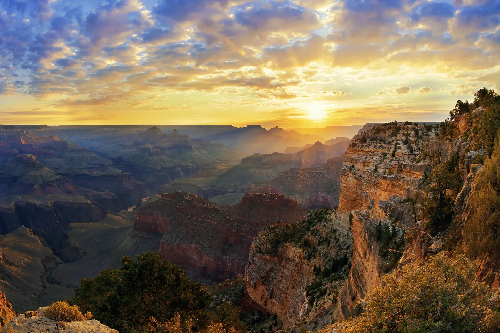
Sunrise and sunset are the most popular moments at the viewpoints. Here are the times calculated for the 15th of each month at Mather Point, in Arizona time.
| Month | Sunrise | Sunset | Day length |
|---|---|---|---|
| January | 7:38 am | 5:37 pm | 9 h 59 min |
| February | 7:15 am | 6:09 pm | 10 h 54 min |
| March | 6:39 am | 6:35 pm | 11 h 57 min |
| April | 5:55 am | 7:02 pm | 13 h 07 min |
| May | 5:22 am | 7:27 pm | 14 h 05 min |
| June | 5:11 am | 7:47 pm | 14 h 36 min |
| July | 5:23 am | 7:45 pm | 14 h 22 min |
| August | 5:46 am | 7:18 pm | 13 h 32 min |
| September | 6:10 am | 6:35 pm | 12 h 25 min |
| October | 6:35 am | 5:52 pm | 11 h 17 min |
| November | 7:04 am | 5:20 pm | 10 h 16 min |
| December | 7:31 am | 5:15 pm | 9 h 44 min |
To compare with other destinations, see where to go in May and where to go in September.
Budget for visiting the Grand Canyon
| Item | Budget | Comfort |
|---|---|---|
| Accommodation (shared double room, or camping) | about US$35 to 80 | about US$135 to 280 |
| Meals | about US$30 to 45 | about US$55 to 100 |
| Rental car and gas (shared) | about US$35 to 55 | about US$55 to 90 |
| Park entry (see above) and activities | depends on the number of travelers | helicopter flights, rafting extra |
| Total per day, excluding entry | roughly US$100 to 180 | roughly US$245 to 470 |
To save money: book park lodges very early, or stay in Tusayan, Williams or Flagstaff; shop for groceries before entering the park, and use the free shuttles.
Where to stay at the Grand Canyon?
- In the park, South Rim: the historic lodges (El Tovar, Bright Angel, Maswik, Yavapai…) and the Mather and Desert View campgrounds; book months ahead for summer.
- Tusayan: a few kilometers from the South Entrance, chain hotels and restaurants.
- Williams and Flagstaff: more choice and lower prices, 1 h to 1 h 30 min from the park; Williams keeps its Route 66 atmosphere.
- At the bottom of the canyon: Phantom Ranch, reserved by lottery, and campgrounds with a permit from the park.
- North Rim: no services in fall 2026 according to the NPS; check the season’s options before planning a stay.
Entry requirements, health and safety
- US citizens: a trip to the Grand Canyon is domestic travel, with no entry formalities.
- UK citizens: according to the UK FCDO (GOV.UK, updated 18 August 2026), you need an approved ESTA (only via the official ESTA website or ESTA Mobile app) or a US visa before you travel; some travel histories (Cuba since 12 January 2021, Iran, Iraq, Libya, North Korea, Somalia, Sudan, Syria or Yemen since March 2011) and arrests or criminal records can make you ineligible. Your passport must be valid for the length of your stay.
- Health: medical treatment is expensive and some hospitals ask non-residents for a deposit; UK prescriptions are not valid in the US (GOV.UK). Take out insurance covering medical costs. Emergency number: 911.
- Driving: GOV.UK says you can use a UK photocard driving licence, but you may also need the 1949 international driving permit (IDP), depending on the state, and car hire companies may set stricter conditions.
- Hiking: GOV.UK advises checking weather forecasts and conditions, being properly equipped, leaving a copy of your itinerary with someone and checking the National Park Service website; stay on marked trails, follow rangers’ instructions and stay behind the railings at viewpoints.
- Natural hazards: according to GOV.UK, flash floods can occur (check National Weather Service warnings) and wildfires are a danger in many dry areas: follow evacuation orders.
- Altitude: the South Rim is above 2,000 m (6,600 ft); GOV.UK notes that altitude sickness is a risk in parts of the US. Drink plenty, the air is dry.
See our travel insurance guide.
Practical tips for the Grand Canyon
- Water: refill stations exist on the South Rim and on some trails; carry a large water bottle and check the NPS hiking messages for drinking water inside the canyon.
- Bookings: lodges, Phantom Ranch, flightseeing and rafting are booked well in advance for summer.
- Wildlife: keep your distance from elk and never feed any animal.
- Tipping: customary in the US, generally 15 to 20% in restaurants.
- Mobile data: coverage is fair in the village and absent in the canyon; a US eSIM avoids roaming charges (see our eSIM guide). Download offline maps.
Frequently asked questions
Which rim of the Grand Canyon should you choose?
The South Rim for a first trip: open all year, more viewpoints and services. The North Rim, higher and quieter, is seasonal, and in fall 2026 limited to day use with no services after the 2025 fire, according to the NPS.
What is the best time to visit the Grand Canyon?
Mid-April to early June and mid-September to mid-October. In summer, the rim stays pleasant but the bottom of the canyon averages over 38 °C (100 °F) in the afternoon according to NOAA normals, and storms are frequent in July-August.
How much does Grand Canyon entry cost in 2026?
According to the NPS, $35 per vehicle for 7 days, plus $100 per non-US resident aged 16 and over, unless entering with an America the Beautiful pass ($250 for non-residents).
What time is it at the Grand Canyon?
Arizona time, UTC−7 all year, with no daylight saving: 7 hours behind London in winter, 8 in summer. Las Vegas is on the same time in summer but one hour behind in winter.
Can you hike to the bottom of the Grand Canyon in a day?
Rangers advise against it: about 1,400 m (4,600 ft) of elevation change and much greater heat at the bottom. Hike part of a trail, or book a night at Phantom Ranch or a camping permit.
How many days should you plan at the Grand Canyon?
One day for a glimpse of the South Rim, two to see sunrise and sunset and walk a little, three or four with a hike down into the canyon.
Our sources
- Entry, safety and health information read on 26 October 2026: UK FCDO, foreign travel advice for the USA (GOV.UK, updated 18 August 2026)
- Climate normals: NOAA (National Centers for Environmental Information / National Weather Service) 1991-2020 normals for the Grand Canyon NP 2 (South Rim, 2,068 m / 6,785 ft), Bright Angel Ranger Station (North Rim) and Phantom Ranch (canyon bottom) stations, as reported by Wikipedia (articles « Grand Canyon Village, Arizona », « Grand Canyon National Park » and « Phantom Ranch »)
- National Park Service, Grand Canyon National Park: Fees & Passes (updated 20 July 2026) and Alerts & Conditions (updated 26 October 2026), checked 26 October 2026
- IANA time zone database (America/Phoenix, America/Los_Angeles, America/Denver, America/New_York and Europe/London zones), via Python’s zoneinfo module
- Destination de Voyage calculations: conversion of normals, temperature gaps, sunrise and sunset (NOAA solar algorithm), time differences and entrance fee comparison
- European Central Bank euro reference rates, 23 October 2026 (budget conversions)
- Our methodology
Updated October 2026.