Things to do in Saint-Malo begin with a walk round the ramparts, then getting lost in the streets of the walled town (intra-muros), walking out to the Grand Bé at low tide to see Chateaubriand’s tomb, reaching Fort National, following Le Sillon beach, visiting the Grand Aquarium, and heading to Saint-Servan for the Cité d’Alet and the Solidor tower. To visit Saint-Malo calmly, one rule matters more than any other: check the tide times, as the tides here are among the strongest in Europe.
The old corsair city, on the Emerald Coast (Côte d’Émeraude) in Ille-et-Vilaine, has direct TGV trains to Paris-Montparnasse. This guide covers the highlights, a one-day plan, the tides explained simply (with a calculation of how fast the water rises), the month-by-month climate based on Météo-France and our often surprising sunshine comparison with Paris.

Our travel deals for Saint-Malo
Affiliate links: we earn a commission, at no extra cost to you.
 FlightsKiwi.comCompare flights and airline combinations to Saint-Malo.Compare flights

Saint-Malo at a glance
- Location Emerald CoastNorth of Ille-et-Vilaine, at the mouth of the Rance, opposite Dinard
- Getting there direct TGV to Paris-Montparnasse; Dinard-Pleurtuit airport about 13 km (8 mi) away · details
- Entry Schengen rules: US and UK citizens visa-free up to 90 days; time zone: CET (UTC+1, UTC+2 in summer), one hour ahead of London · details
- Currency euro · currencies
- Electricity 220 V, 50 Hz, type E sockets; US plugs need an adapter (france.fr, checked 26 October 2026)
- Tides tidal range of up to 14 m (46 ft)Grand Bé and Fort National accessible only at low tide
- Suggested length 1 day for the town2 to 4 days with Dinard, Cancale and Mont-Saint-Michel
- Best time May-June and SeptemberJuly-August for swimming, with crowds
- Budget see our budget section
Things to do in Saint-Malo: the highlights
Walk the ramparts
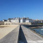
This is the first thing to do. The wall walk goes all the way round the walled town and is free to walk, taking about an hour at a gentle pace. It looks out over the harbour, the beaches, the Grand Bé, Fort National and, on a clear day, Dinard and the island of Cézembre. If you can, go up twice: at high tide, when the sea beats against the foot of the walls, and at low tide, when hundreds of metres of sand and rock are exposed. Across the Rance, our guide to things to do in Dinard covers the neighbouring seaside resort.
Intra-muros and Saint-Vincent cathedral
The walled town was largely destroyed in 1944, then rebuilt as it was in its original granite. Wander between Place Chateaubriand, the Grande Rue, Rue Saint-Vincent and the small shopping streets. Saint-Vincent cathedral, at the heart of the town, is worth a visit for its contemporary stained glass. The castle, at the entrance to the town near the Porte Saint-Vincent, houses the town history museum. Keep time for a crêperie and a sweet break: that is part of the pleasure too.
The Grand Bé and Fort National, at low tide
The Grand Bé is a rocky islet you can reach on foot from Bon-Secours beach, only at low tide. Chateaubriand, who was born in Saint-Malo, is buried there facing the sea. Next to it, the Petit Bé fort can also be visited depending on the tide. Fort National, built at the end of the 17th century on a rock off Éventail beach, is also accessible only at low tide. Before you set off, check the time of high water: the sea comes back quickly and people are regularly caught out on the causeway.
The beaches: Bon-Secours, L’Éventail and Le Sillon
At the foot of the ramparts, Bon-Secours beach has a seawater pool, refilled at every high tide, with a diving board that appears in many photos of Saint-Malo. Éventail beach, next to the Porte Saint-Thomas, faces Fort National. Le Sillon, a long beach running towards Paramé and Rothéneuf, is lined by a promenade sea wall and wooden breakwaters. During spring tides, waves sometimes break over the sea wall: a popular sight, but keep your distance.
The Grand Aquarium and rainy-day options
A little way from the centre, the Grand Aquarium is the most popular family outing and a good choice on a grey day. In the walled town, the corsair’s house of the Hôtel d’Asfeld can also be visited, as can the Maison du Québec, which recalls the role of Jacques Cartier, another famous native of Saint-Malo. A cruise in the bay or on the Rance is another option when the sea is calm.
Saint-Servan: Cité d’Alet and the Solidor tower
South of the walled town, the former municipality of Saint-Servan has a different feel. The Cité d’Alet, the peninsula where the original town stood, has a path above the Rance and the sea, with views of the ramparts. Below, the 14th-century Solidor tower guards the mouth of the Rance. It makes a lovely late-afternoon walk, quieter than intra-muros in summer.
Rothéneuf and its carved rocks
To the east, towards the Pointe de la Varde, the Rothéneuf district is known for its rocks carved at the end of the 19th century by a priest, Abbé Fouré, who cut several hundred figures into the granite at the cliff edge. You can continue to Minihic beach, the Havre de Rothéneuf and the malouinières, the large shipowners’ mansions built in the countryside around Saint-Malo.
Around Saint-Malo: Dinard, Cancale and Mont-Saint-Michel
Dinard, opposite, about 18 km (11 mi) by road via the dam of the Rance tidal power station, can also be reached by boat depending on the season. Cancale, at the end of the Emerald Coast, is the oyster capital; the nearby Pointe du Grouin offers one of the finest views on the coast. Mont-Saint-Michel is about an hour’s drive away: see our guide to visiting Mont-Saint-Michel to avoid peak times. Further west, see our pages on the Crozon peninsula and Belle-Île-en-Mer.
Tides in Saint-Malo: what to know before you go
The tides in the Bay of Saint-Malo are among the biggest in Europe: the tidal range, the difference between low and high water, can reach 14 metres (46 ft). That is why the Rance tidal power station was built here in the 1960s. For visitors, it changes everything: the same beach can be a few metres or several hundred metres wide depending on the time.
Tides: useful notions
- Rhythm: two high and two low tides a day; the average interval between two high tides is about 12 h 25 min
- In practice: the tide shifts by about 50 minutes from one day to the next (2 × 12 h 25 = 24 h 50)
- Coefficient: from 20 to 120, calculated by SHOM (the French hydrographic office) for Brest and valid for the Channel and the Atlantic
- Spring tides: coefficient above 70 (95 = average spring tide); very big tides above 100, often around the equinoxes
- Neap tides: coefficient below 70 (45 = average neap tide), small difference between high and low water
How fast does the sea rise? Our calculation
The « rule of twelfths », taught in navigation, gives an approximation of how the water rises over the roughly six hours between low and high water: 1/12 of the range in the first hour, 2/12 in the second, 3/12 in the third, 3/12 in the fourth, 2/12 in the fifth and 1/12 in the sixth. We applied it to the maximum range of 14 m (46 ft) quoted for Saint-Malo.
| Hour of the tide | Share of the range | Rise | Per minute | Cumulative |
|---|---|---|---|---|
| 1st hour | 1/12 | 1.2 m (3.8 ft) | 1.9 cm (0.7 in) | 1.2 m (3.8 ft) |
| 2nd hour | 2/12 | 2.3 m (7.7 ft) | 3.9 cm (1.5 in) | 3.5 m (11.5 ft) |
| 3rd hour | 3/12 | 3.5 m (11.5 ft) | 5.8 cm (2.3 in) | 7.0 m (23.0 ft) |
| 4th hour | 3/12 | 3.5 m (11.5 ft) | 5.8 cm (2.3 in) | 10.5 m (34.4 ft) |
| 5th hour | 2/12 | 2.3 m (7.7 ft) | 3.9 cm (1.5 in) | 12.8 m (42.1 ft) |
| 6th hour | 1/12 | 1.2 m (3.8 ft) | 1.9 cm (0.7 in) | 14.0 m (45.9 ft) |
Key takeaway: on a very big tide, the water can rise by around 3.5 m (11.5 ft) an hour during the third and fourth hours, or about 6 cm (2.3 in) a minute in height. On an almost flat foreshore, that means the water advances horizontally much faster. For the Grand Bé or Fort National, set off just after low water and come back well before mid-tide on the rising tide. Official times are published by SHOM and displayed on site.
Common mistakes: looking only at the previous day’s high-water time (it has shifted by about 50 minutes), forgetting that the coefficient changes the range, and lingering on the Grand Bé causeway when the sea starts to come back in.
When to go to Saint-Malo
The best periods are May-June and September. The climate is mild and oceanic: at Dinard, the average high does not exceed 22.3 °C (72 °F, in August) and winters are cool but rarely icy (9.1 °C, 48 °F, in the afternoon in January). Annual rainfall is 752 mm (29.6 in), less than people often imagine, but spread over nearly 128 days, with wetter autumns and winters (89 mm, 3.5 in, in November). July is the driest month (46.1 mm, 1.8 in) and the sunniest.
When to go to Saint-Malo: key points
- Best periods: May, June and September
- Swimming: July-August, cool water; highs of 22 °C (72 °F)
- Spectacular spring tides: often around the equinoxes (March, September), check the SHOM tide tables
- Driest month: July, 46.1 mm (1.8 in) and 7.6 rainy days on average
- Wettest month: November, 89 mm (3.5 in) and 14 rainy days
- Good to know: intra-muros is very busy in July-August and on spring weekends
| Month | High °C (°F) | Low °C (°F) | Rain mm (in) | Crowds | Prices | Verdict |
|---|---|---|---|---|---|---|
| January | 9.1 (48) | 3.8 (39) | 64 (2.5) | Very low | Low | ⚠️ Cool and damp, quiet town |
| February | 9.8 (50) | 3.6 (38) | 56 (2.2) | Very low | Low | ⚠️ Still cool, big tides possible |
| March | 12.2 (54) | 4.9 (41) | 47.6 (1.9) | Low | Low | ✅ Few people, equinox tides |
| April | 14.5 (58) | 6.2 (43) | 53.9 (2.1) | Medium (Easter) | Medium | ✅ Lengthening days |
| May | 17.3 (63) | 9.1 (48) | 56 (2.2) | High (public holidays) | Medium to high | ✅ Good month, busy long weekends |
| June | 20.2 (68) | 11.8 (53) | 54.1 (2.1) | High | High | ✅ Very good month, late sunsets |
| July | 22.1 (72) | 13.6 (56) | 46.1 (1.8) | Very high | Very high | ⚠️ The driest, but crowded |
| August | 22.3 (72) | 13.7 (57) | 58.3 (2.3) | Very high | Very high | ⚠️ Warm for the region, crowded |
| September | 20.3 (69) | 11.8 (53) | 60.2 (2.4) | Medium | Medium | ✅ Ideal late season |
| October | 16.5 (62) | 9.7 (49) | 81.3 (3.2) | Low | Medium to low | ⚠️ Autumn rain, soft light |
| November | 12.4 (54) | 6.5 (44) | 89 (3.5) | Very low | Low | ❌ The wettest, windy |
| December | 9.7 (49) | 4.2 (40) | 85.5 (3.4) | Low | Low | ⚠️ Cool, festive lights, few people |
Is Saint-Malo sunnier than Paris? Our comparison
Brittany has a grey reputation, but Météo-France figures paint a more nuanced picture. We compared, month by month, the hours of sunshine at the Dinard station (the closest to Saint-Malo) and at Paris-Montsouris over the same 1991-2020 period, and added the sunset time on the 15th of each month.
| Month | Sunshine Dinard | Sunshine Paris | Difference | Sunset on the 15th | Day length on the 15th |
|---|---|---|---|---|---|
| January | 68.7 h | 59.0 h | +10 h | 17:38 | 8 h 42 |
| February | 91.2 h | 83.7 h | +8 h | 18:27 | 10 h 11 |
| March | 132.7 h | 134.9 h | −2 h | 19:12 | 11 h 49 |
| April | 178.9 h | 177.3 h | +2 h | 20:58 | 13 h 39 |
| May | 202.6 h | 201.0 h | +2 h | 21:40 | 15 h 13 |
| June | 207.5 h | 203.5 h | +4 h | 22:11 | 16 h 07 |
| July | 220.7 h | 222.4 h | −2 h | 22:06 | 15 h 45 |
| August | 201.4 h | 215.3 h | −14 h | 21:24 | 14 h 24 |
| September | 170.1 h | 174.7 h | −5 h | 20:22 | 12 h 38 |
| October | 114.2 h | 118.6 h | −4 h | 19:20 | 10 h 53 |
| November | 79.6 h | 69.8 h | +10 h | 17:29 | 9 h 13 |
| December | 65.8 h | 56.9 h | +9 h | 17:12 | 8 h 18 |
| Year | 1,733.4 h | 1,717.0 h | +16 h |
Result: over the year, the Saint-Malo coast gets slightly more sunshine than Paris (+16 hours). It is clearly better off in winter (+10 h in January and November, +9 h in December), level in spring, while Paris takes the lead in August (−14 h) and early autumn. Another summer bonus: lying further west, Saint-Malo sees the sun set after 10 pm in mid-June, which means very long evenings on the ramparts.
- Spring (March to May): 12 to 17 °C (54 to 63 °F) in the afternoon, less rain, and days longer than 15 hours in May. The March equinox tides draw photographers. Easter and May weekends are busy.
- Summer (June to August): 20 to 22 °C (68 to 72 °F), and the water stays cool. This is high season: car parks full, intra-muros packed in the afternoon. Come early in the morning or in the evening, and book accommodation well ahead. See also our ideas for where to go in June.
- Autumn (September to November): September is often the best compromise (20.3 °C, 69 °F, 9.4 rainy days). October and November turn wet and windy, with storms that put on a show along Le Sillon. More ideas in our selection of where to go in September.
- Winter (December to February): 9 to 10 °C (48 to 50 °F) in the afternoon, few tourists, low prices. Pack a raincoat and windbreaker; the town is very enjoyable out of season.
Itinerary: Saint-Malo in one day
This plan assumes you fit the day around the tide. Reverse it if low water falls in the afternoon.
- 9 am: arrive through the Porte Saint-Vincent and walk all the way round the ramparts (about 1 hour).
- 10:30 am: if low water is late morning, cross to the Grand Bé from Bon-Secours beach, or to Fort National from Éventail beach.
- 12:30 pm: lunch in the walled town (crêpes, seafood).
- 2 pm: Saint-Vincent cathedral, the shopping streets, the history museum in the castle.
- 3:30 pm: the Grand Aquarium (with children or in bad weather) or a walk along the Sillon sea wall.
- 5:30 pm: the Cité d’Alet and the Solidor tower in Saint-Servan.
- Sunset: back on the west side of the ramparts or at Bon-Secours beach (after 10 pm in late June, before 5:30 pm in December).
In 3 days: day 1 Saint-Malo; day 2 Cancale, the Pointe du Grouin and Rothéneuf; day 3 Dinard and Saint-Lunaire, or a trip to Mont-Saint-Michel. With more time, the Pink Granite Coast or the Quiberon peninsula fit well into a trip to Brittany.
Budget in Saint-Malo
| Item | Tight budget | Comfortable |
|---|---|---|
| Accommodation (night, double room) | about €60 to 100 (off season); more in summer | about €130 to 250 |
| Meals | about €15 to 25 (crêperie) | about €35 to 60 (seafood) |
| Local transport | on foot, town buses | paid parking, car for the surroundings |
| Activities | ramparts, beaches and Grand Bé free | aquarium, museums, cruise |
Getting to and around Saint-Malo
- Train: Saint-Malo station has direct TGV Atlantique services on the Paris-Montparnasse line (since 2005) and TER Bretagne regional trains via Rennes. Intra-muros is about 20 minutes’ walk away, or a bus ride. Our tips for travelling cheaply by train apply well here.
- Car: handy for Cancale, the Grouin or Mont-Saint-Michel. Parking is scarce in the walled town: use the car parks on the outskirts, with shuttles in season.
- Boat: crossings to Dinard run depending on the season. Saint-Malo harbour is also a ferry port for the Channel Islands and the United Kingdom.
- Plane: Dinard-Pleurtuit-Saint-Malo airport is about 13 km (8 mi) away; from further afield, the main international gateways are the Paris airports, then the train.
Where to stay in Saint-Malo
Intra-muros to do everything on foot and enjoy the town in the evening, once the day visitors have gone: the most expensive and noisiest option in summer. Le Sillon and Paramé for the beach and sea-view hotels. Saint-Servan for a quieter neighbourhood feel, near the Cité d’Alet. Rothéneuf or the surrounding countryside for B&Bs and self-catering cottages, with a car. For July-August, book several months ahead.
Entry requirements, health and safety
- US citizens: France is in the Schengen area, which you may enter for up to 90 days for tourism or business without a visa. Immigration officers may ask for proof of sufficient funds and a return ticket, and France does not recognise the 12-page US emergency passport for visa-free entry (U.S. Department of State, travel.state.gov, last updated August 11, 2025).
- UK citizens: no visa for up to 90 days in any 180-day period as a tourist. Your passport must have been issued less than 10 years before the day you arrive and be valid at least 3 months after the day you plan to leave the Schengen area. The EU Entry/Exit System (EES) may require fingerprints and a photo at your first entry (UK FCDO, GOV.UK, updated 22 October 2026).
- ID: you must be able to prove your identity when asked by the police, or within 4 hours at a police station (GOV.UK, updated 22 October 2026).
- Health and emergencies: UK travellers need a GHIC or a valid EHIC for medically necessary state healthcare, which is not a substitute for travel insurance; the European emergency number is 112 (GOV.UK).
- Swimming: sea conditions can be dangerous even for strong swimmers, and some beaches have strong undercurrents, especially along the Atlantic coast. Learn the flag system and follow lifeguards’ advice (GOV.UK, updated 22 October 2026).
- Saint-Malo risks: the main dangers are linked to the sea: the rising tide on the Grand Bé and Fort National causeways, waves breaking over the Sillon sea wall during storms and spring tides, and currents when swimming. Follow the signs and the lifeguard flags.
Travel insurance is not compulsory, but cancellation cover can be useful for non-refundable accommodation in high season: see our guide to travel insurance.
Practical tips for Saint-Malo
- Tides: note the low and high water times every day; they shift by about 50 minutes a day.
- Clothing: windbreaker and raincoat in every season, and shoes that grip on wet rocks.
- Crowds: in summer, visit intra-muros before 10 am or after 6 pm.
- Specialities: Cancale oysters, buckwheat galettes, kouign-amann, salted butter.
- Internet: good mobile coverage; see our guide to travel eSIMs.
- Short break: Saint-Malo is an easy weekend by train; more ideas in our cheap weekend breaks.
Frequently asked questions
What to do in Saint-Malo in one day?
Walk round the ramparts, visit intra-muros and the cathedral, cross to the Grand Bé or Fort National at low tide, then finish at the Cité d’Alet and the Solidor tower or along the Sillon sea wall. Plan the day around the tide times.
Can you walk to the Grand Bé?
Yes, from Bon-Secours beach, only at low tide. Check the time of high water before you go and come back well before the sea returns: on a big tide, the water can rise by around 3.5 m (11.5 ft) an hour in the middle of the flood.
When can you see the big tides in Saint-Malo?
When coefficients are above 100, often around the March and September equinoxes. Official coefficients and times are published by SHOM.
What is the best time to visit Saint-Malo?
May, June and September: 17 to 20 °C (63 to 68 °F) in the afternoon according to Météo-France’s 1991-2020 normals at Dinard, long days and fewer people than in July-August.
Is Saint-Malo sunnier than Paris?
Slightly, over the year: 1,733 hours of sunshine at Dinard against 1,717 at Paris-Montsouris (Météo-France 1991-2020 normals), with a clear advantage in winter but less sun in August.
How do you get to Saint-Malo?
By direct TGV (Paris-Montparnasse line) or by TER via Rennes, then on foot or by bus to intra-muros. There are also ferries from the UK and the Channel Islands, and Dinard-Pleurtuit airport is about 13 km (8 mi) away.
Our sources
- Météo-France: 1991-2020 climate data sheets for Dinard (35228001) and Paris-Montsouris (75114001)
- Wikipedia: « Saint-Malo » (tides, tidal range), « Calcul de marée » (coefficient, SHOM definitions, rule of twelfths) and « Gare de Saint-Malo » articles
- Destination de Voyage calculations: sunshine differences, rule of twelfths, sunset and day length (NOAA algorithm)
- Entry requirements, health and safety checked on 26 October 2026: U.S. Department of State, France country information (last updated August 11, 2025) and UK FCDO, GOV.UK foreign travel advice for France (updated 22 October 2026)
- France tourism board (france.fr), electricity requirements, checked 26 October 2026
- Our methodology
Updated October 2026.
For more ideas, see our Brittany guide, our page on neighbouring Normandy and our France travel guide.